EVA Report – December 29th

Report title: EVA Report
Crew #: 326
Position: Biologist
Report prepared by: Armand Destin
Date: 29-12-2025
Sol: 1

EVA #: 2
Purpose of EVA: Testing EVA Preparation, Testing ATVs, Testing EVA Suits
Start time: 13:30
End time: 15:30
Narrative: Three crew members conducted the first EVA of the mission. Collected rock samples. Proceeded back to rovers and then returned to HAB.
Destination per MDRS Map: Marble Ritual
Destination Coordinates (use UTM WGS 84): N518750, E4251000
EVA Participants: Keegan Chavez (Commander), Katarina Guth (Health and Safety Officer), Vindhya Ganti (GreenHab Officer)
Road(s) and routes per MDRS Map: North on Cow dung road to Marble Ritual, will park around Marble Ritual and continue on foot
Mode of travel: Opportunity and Perseverance

EVA Report – December 30th

Report title: EVA Report
Crew #: 326
Position: Scientist
Report prepared by: Benjamin Huber
Date: 30-12-2025
Sol: 2
EVA #: 3
Purpose of EVA: Gathering geologic samples for research (creating bricks from geologic samples), specifically concretions from area on the hab ridge
Start time: 1000
End time: 1300
Narrative: Walked the correct route and reached about the same coordinates as given in request, but concretion site could not be seen from the road or located when the team went off road. The team was running low on time, so alternative geological samples were taken. The team, after the samples were taken, went back to the hab, the same way they ascended the ridge.
Destination per MDRS Map: Hab Ridge
Destination Coordinates (use UTM WGS 84): (N4249900 – N42501200), (E517900 – E518200)
EVA Participants: Armand Destin (Crew Biologist), Benjamin Huber (Crew Scientist), Daria Bardus (Crew Journalist)
Road(s) and routes per MDRS Map: Follow footpath 1103 north from the hab to Hab Ridge Rd. Follow Hab Ridge Rd south until the concretion site is reached.
Mode of travel: Walking

EVA Report – December 31st

Report title: EVA Report
Crew #: 326
Position: Biologist
Report prepared by: Armand Destin
Date: 31-12-2025
Sol: 3
EVA #: 4
Purpose of EVA: Environmental Sensor placement for research, Capture images for rover’s autonomous navigations.
Start time: 09:00
End time: 13:00
Narrative: Traveled to Kissing Camel Ridge. Successfully placed sensors and captured images for research projects. The team finished the EVA tasks early and decided to return to the Hab.
Destination per MDRS Map: Kissing Camel West and East
Destination Coordinates (use UTM WGS 84): (N42492500 – N4250000), (E518000 – E519500)
EVA Participants: Katarina Guth (Health and Safety Officer), Vindhya Ganti (GreenHab Officer), Idris Stevenson (Crew Engineer),
Road(s) and routes per MDRS Map: Driving south on Cow Dung Road, then park the rovers near the Kissing Camel Ridge. Walk along the ridge.
Mode of travel: Driving (Curiosity and Perseverance) and Walking

EVA Report – October 15th

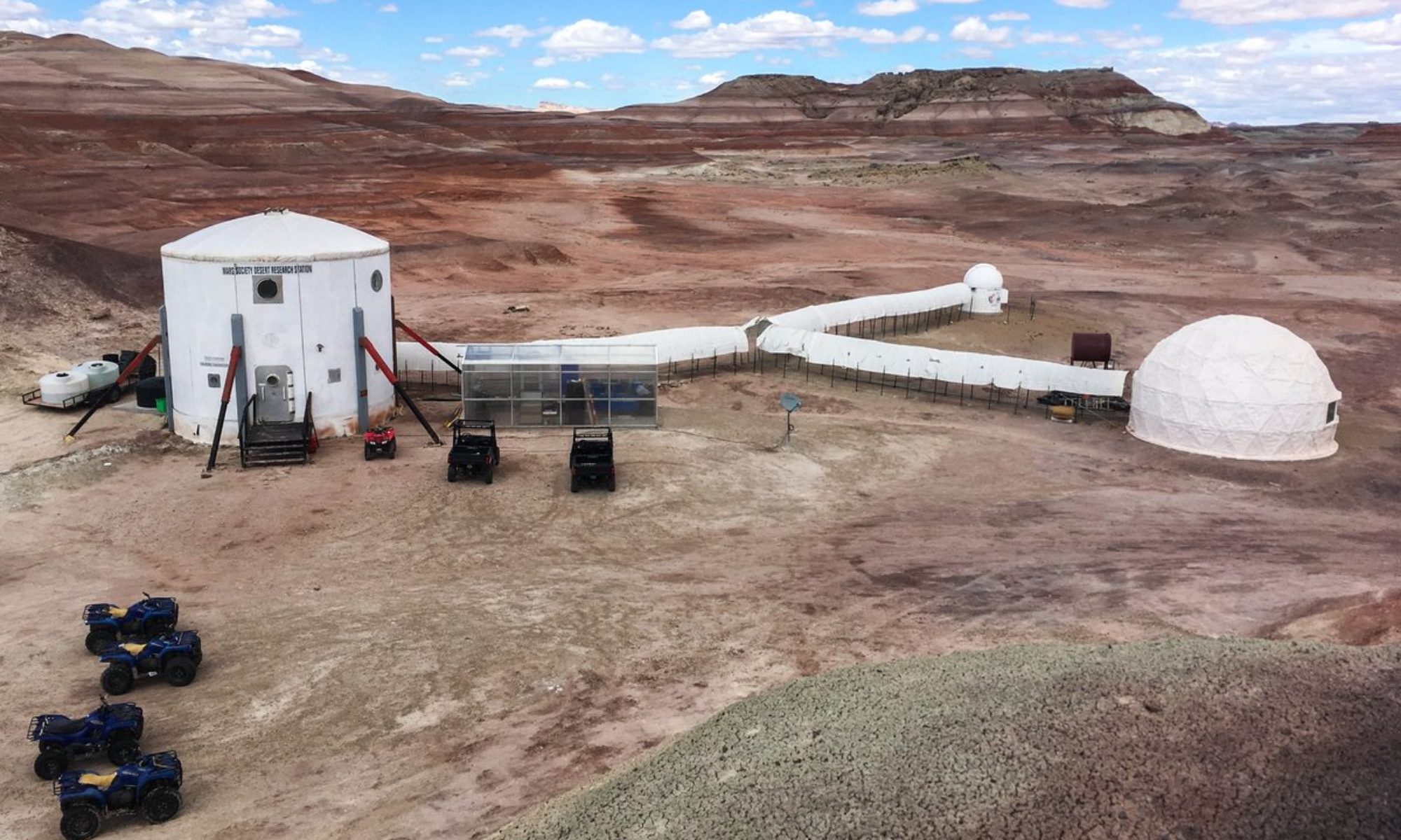
Report title: EVA 1 Report
Crew #: 319
Position: Commander
Report prepared by: Rym Y. Chaid
Date: 15-10-2025
Sol: 3

EVA #: 1

Purpose of EVA: Training

Sol time: 1300
End time: 1400

Narrative:

The EVA 1 crew initiated operations with successful donning and doffing procedures for the analog suits, followed by standard pre-EVA checks and communication tests. Airlock depressurization was nominal, and all COMS were confirmed functional prior to egress.

Shortly after departure, the EVA team received a partial abort directive from Mission Support Center. In response, Commander Rym and Crew Engineer Ricardo executed an immediate safety and route reassessment, returning to RAM Station to adjust mission plan.

Following the directive, the crew transferred from two rovers to one, with Commander Rym parking Rover Curiosity and joining Crew Engineer Ricardo aboard Rover Perseverance. The crew ensured all vehicles were powered down and secured prior to consolidation.

After confirming mission parameters and receiving clearance from CapCom, EVA 1 proceeded nominally. The Perseverance rover departed RAM Station and navigated toward Marble Ritual, while maintaining full communication link with HabCom. Upon arrival, the EVA Crew parked the rover, confirmed vehicle stability, and explored on foot the Marble Ritual site.

The Crew Engineer Ricardo and Commander Rym then conducted short-distance traverses on stable terrain to assess suit mobility, visibility, and communication performance under field conditions. Environmental awareness was maintained at all times, with situational monitoring for non-simulation external activity. It was very windy!

Upon completion of surface exploration, the crew returned to Rover Perseverance and conducted a nominal return transit to MDRS Station. Airlock repressurization and post EVA safety checks were completed successfully, with all systems and personnel confirmed safe and in good condition.

Destination per MDRS Map: Marble Ritual
Destination Coordinates (use UTM WGS 84): 338.4092400, -110.7834478
EVA Participants: Rym Chaid + Ricardo Gonzales
Road(s) and routes per MDRS Map: Marble Ritual via Moon Walk Road and N Cow Dung Road
Mode of travel: Perseverance rover + exploration around the area by walk

EVA Report – October 17th

Report title: EVA Report
Crew #: 319
Position: HSO / Crew Scientist
Report prepared by: Shriya Musuku; Reviewed by Engineer Ricardo Gonzalez
Date: (17-10-2025)
Sol: 5

EVA #: 3

Purpose of EVA: Geology
Start time: 0900
End time: 1025

Narrative: The EVA started with the purpose of proceeding to cowboy corner via rover and walking to Tharsis Montes via foot to collect geology samples. The crew started out well and in high spirits and reached about halfway before completely losing comms with the habcom. We returned to a point where we could hear them but continued to have a loss of communication due to significant noise. Upon miscommunication, we remained on standby near Galileo road before being asked to return. The noise in our communications led to the understanding that the EVA crew could not communicate with each other, although we were able to hear each other on Channel 2. We returned in high spirits after having enjoyed the weather and getting practice in operating our EVA suits despite not achieving our original mission. The team had a significant learning lesson and developed an improved communications plan for our next EVA, and affirmed over the course of the day that the repeater was interfered with in our canyon, causing the noise or loss of contact with the long range communication (channel 1). We returned on time and were in high spirits despite the situation.

Destination per MDRS Map:
Departure Point: MDRS Base
Rover Drop: Cowboy Corner
Furthest Exploration Point: Tharsis Montes

Destination Coordinates (use UTM WGS 84): 519500 – 4253500

EVA Participants:
Scientist – Shriya Musku
GreenHab Officer – Mackenzie Calle
HabCom: Commander Rym and Engineer Ricardo

Road(s) and routes per MDRS Map:
Cow Dung Road 0110

Mode of travel:
Spirit Rover + walking

EVA Report – <date – October 18th>

Report title: EVA Report
Crew #: 319
Position: HSO / Crew Scientist
Report prepared by: Shriya Musuku; Reviewed by Engineer Ricardo Gonzalez
Date: (18-10-2025)
Sol: 6

EVA #: 5
Purpose of EVA: Geology
Start time: 0900
End time: 1109

Narrative:

EVA Crew Ricardo and Shriya left in high spirits and proceeded to their destination. The crew proceeded along the road where we took a first right to remain on the main road and off the campsite. As we reached the area, HabCom noticed that our comms were cutting out due to the gorges and had a short period of no response. During this time, HABCOM was also troubleshooting their communication systems which were having some failures.

As we were figuring out the landscape and trying to identify which road was Galileo Road and navigate where the next terrain led, we requested HABCOM permission to cross the road and proceed slightly further to scope out the area before we backtracked to our sample collection location. With permission from Mission Support, we proceeded to 518000/4254500 on Cow Dung Road and returned back to Pooh’s Corner after understanding that we were looking at Tharsis Montes ahead of us.

There, the crew collected pictures, Martian flowers, and geology samples as we walked around. The crew was able to successfully figure out where yesterday’s EVA crews had gone and to improve our navigation skills. We also found an abandoned kindle device and dropped a marble at Marble Ritual site after getting permission from HABCOM. We returned safely and happily, albeit a little tired at the end of the EVA. We are glad about our successful research outcomes and explorations.

Destination per MDRS Map:
Departure Point: MDRS Base
Rover Drop: The Peanut
Walk around the Peanut on route to Tharsis Montes
Furthest Exploration Point: Tharsis Montes

Destination Coordinates (use UTM WGS 84):
Departure Point: MDRS Base
Rover Drop: Pooh’s Corner
Furthest Exploration Point: Intersection of Cow Dung Road 0110 and Galileo Road 1104

EVA Participants:
Scientist – Shriya
Engineer – Ricardo
HABCOM: Journalist Mackenzie and Commander Rym

Road(s) and routes per MDRS Map:
Cow Dung Road 0110
Galileo Road 1104
Mode of travel:
Curiosity Rover + walking

EVA Report – <date – October 20th>

Journalist Report
Crew 319
Position: Crew Journalist
Report prepared by: Mackenzie Calle
Date: 20-10-2025
Sol: 8

Report from Sol 8

Reporting from Sol 8 10.20.25 17:50PM

Crew 319 enjoyed a more restful Sunday evening and caught up on some sleep before heading out on two, three-hour EVAs today, the longest we have achieved so far. EVA Crew 1 with Commander Rym Chaid and Crew Scientist Shriya Musuku took Perseverance Rover to the dinosaur quarry at the Gateway to Lith to explore the terrain before collecting mineral samples at Cowboy Corner, including some surprise pieces of what appears to be quartz. EVA Crew 2 with Crew Engineer Ricardo J. Gonzalez and Crew Journalist Mackenzie Calle took Opportunity Rover for its first EVA of our mission and headed to Somerville Overlook and were astounded at the views of the canyons and plateaus that we could see for miles. They also collected many geological samples, especially those that had crystalline and botryoidal structures. We noticed a strong sprinkling of red rock amongst the soft clay. The marbling in the canyon plateaus was also very strong.

The two EVAs were very productive and encouraging for both crews.

EVA Report – <date – October 20th>

Report title: EVA Report
Crew #: 319
Position: HSO / Crew Scientist
Report prepared by: Shriya Musuku;
Reviewed by: Commander Rym Chaid
Date: (20-10-2025)
Sol: 8

EVA #: 7

Purpose of EVA: Geology
Start time: 0900
End time: 1205

Narrative: The EVA crew left the main hab on the perseverance rover in good spirits and under amazing weather. The crew proceeded to the Gateway to Lith dinosaur quarry and followed the pathway without an interruption. Once in the dinosaur quarry, the crew was able to explore the beautiful terrain, found Martian water, and was able to get some media documentation of our exploration. Additionally, we saw several cool rocks that formed in the area and were able to collect a few geology samples. Once done with our sampling, we left the quarry and proceeded back to the MDRS base with our Plan B, Cowboy Corner, as a pit stop. There, we also collected samples and documented our experience while enjoying the beautiful sun. We also encountered an alien on foot and proceeded to stay away from them to keep ourselves safe. Finally, we made it back to the MDRS base after an amazing, safe, and productive EVA.

Destination per MDRS Map:
Plan A: Gateway to Lith
Plan B (contingency): Cowboy Corner

Destination Coordinates (use UTM WGS 84):
Plan A: 518250, 4255750
Plan B (contingency): 518750, 4253000

EVA Participants:
Shriya Musuku & Rym Chaid
HABCOM: Ricardo and Mackenzie

Road(s) and routes per MDRS Map:
Cow Dung Road 0110

Mode of travel:
Driving (Perseverance)
Walking

EVA Report – <date – October 21st>

Report title: EVA Report
Crew #: 319
Position: HSO / Crew Scientist
Report prepared by: Shriya Musuku
Reviewed by: Commander Rym Chaid
Date: 21-10-2025
Sol: 9

EVA #: 9

Purpose of EVA: Exploration / First Response Training
Start time: 0910
End time: 1105

Narrative: The crew left for the beautiful morning EVA with full energy and explored the valley behind the Hab and practiced splinting in EVA gear to explore how rescues can be done in case of an emergency, without the movement restrictions of the gear. Journalist Mackenzie who had minimal prior experience in medical response was the trainee and Scientist Shriya was the patient and trainer as she talked her through a response to splinting a long bone scenario and a joint. After that, the crew explored the beautiful valleys and peaks behind the hab, collected rocks, said hello to the Crew Engineer in the hab from afar, and finally made their way back into the hab. With much joy and dancing (literally!), the crew achieved not only the goals of the experiment but also crew bonding time through this EVA.

Destination per MDRS Map:
Valley behind the HAB

Destination Coordinates (use UTM WGS 84):
518000, 4251000

EVA Participants:
Shriya Musuku, Mackenzie Calle, & Rym Chaid
HABCOM: Ricardo Gonzales

Road(s) and routes per MDRS Map:
N/A

Mode of travel:
Walking

EVA Report – <date – October 22nd>

Report title: EVA Report
Crew #: 319
Position: Crew Engineer
Report prepared by: Ricardo J. Gonzalez
Date: 22-10-2025
Sol: 10

EVA #: 11

Purpose of EVA: Exploration and Geology sampling
Start time: 09:00
End time: 11:55

Narrative:

Today, Commander, Rym Chaid, and Crew Engineer, Ricardo Gonzalez, embarked on a far journey to Green Mars View. The morning ride was a crisp cool one, filled with sunshine and excitement as they were conducting the longest distanced EVA yet. When the crew arrived at the destination, they were met with a stunning view of deep canyons, with green flat lands and a river at the bottom! At the site, the EVA crew collected a variety of geological samples and captured marvelous images of all the landmarks in view, close and far. They even got to see Martian chipmunks! After some moments of appreciation over the beautiful views of their last EVA of the mission, they safely made their way back to MDRS.
Destination per MDRS Map:
Plan A: Green Mars View
Contingency: Sea Shells

Destination Coordinates (use UTM WGS 84):
Plan A: 520500, 4257000
Contingency: 516500, 4255250

EVA Participants:
Ricardo & Rym
HABCOM: Mackenzie & Shriya

Road(s) and routes per MDRS Map:
Cow Dung Road

Mode of travel:
Rover + Walking

Vehicles you will be using (If applicable): Perseverance

Copyright © The Mars Society. All rights reserved. | Main Site