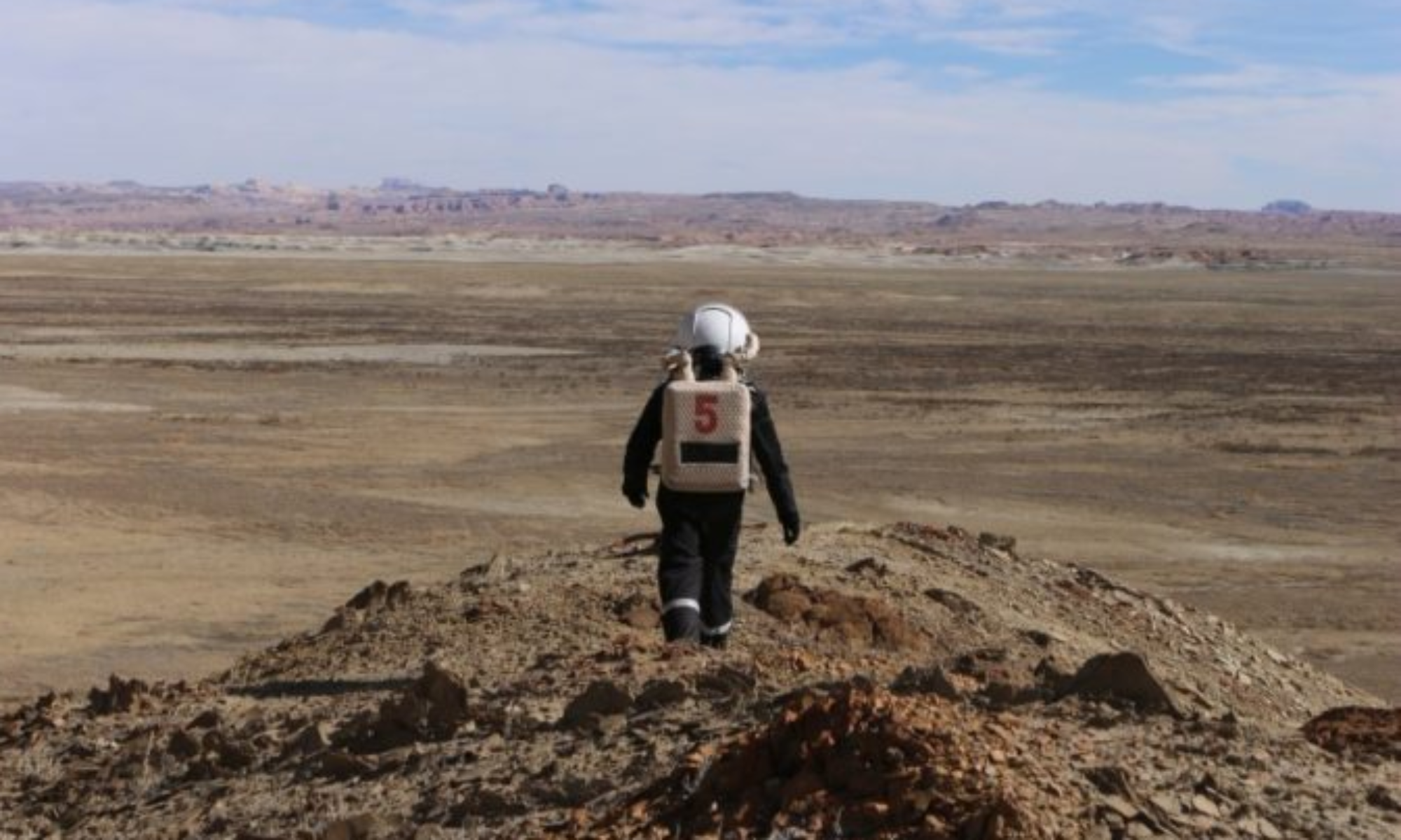

EVA Report – February 25th

Report title: EVA Report

Crew #: 330

Position: Crew Astronomer

Report prepared by: Célia Parnaud–Amy

Date: 25-02-2026

Sol: 10

EVA #: 09

Purpose of EVA:

Exploration of the Kissing Camel zone. We will start with Robert’s Rock Garden and the West side of the feature. If we still have the time, we will survey the East side but staying in sight of Cow Dung Road.

Start time: 9:51

End time: 11:39

Narrative: We went to Robert’s Rock Garden with the rovers and we started exploring Kissing Camel Ridge W. We walked a lot in the canyon, and took a lot of pictures. We used the drone to take panoramic pictures of the zone. The area was really breathtaking. We also took panoramic view of the station with the drone.

Destination per MDRS Map: Kissing Camel Ridge and Robert’s Rock Garden

Destination Coordinates (use UTM WGS 84): 518000E, 4249250N

EVA Participants:

– EVA Leader : Célia, Astronomer

– Lou, Engineer

– Gaspard, Commander

Road(s) and routes per MDRS Map: Cow Dung Road towards South

Mode of travel: driving and walking

EVA Report – February 26th

Report title: EVA Report

Crew #: 330

Position: Journalist

Report prepared by: Adrien Saugnac

Date: (26-02-2026)

Sol: 11

EVA #: 10

Purpose of EVA: Orienteering for photogrammetry experiment

The photogrammetry experiment aims to create 3D maps of the terrain around the MDRS. The quality and usefulness of the map will be assessed by other EVAs, using the map to orient themselves. This maps are created using Drone imagery, and this first EVA aims to map out a first point of interest outside of the station.

Start time: 10 : 30 AM

End time: 12 : 15 AM

Narrative: We went to Compass Rock with Curiosity and Opportunity. Once we were on site, we started an orienteering activity. Gaspard and Adèle searched the points we chose during EVA #7. The activity lasted 30 minutes and then we started using the drone for videos. We gathered interesting datas for the photogrammetry experiment. We couldn’t take a shot while driving the rovers due to a configuration issue but we fixed it after coming back to the station.

Destination per MDRS Map: Compass Rock

Destination Coordinates (use UTM WGS 84): 520000 E, 4252000 N

EVA Participants:

– EVA Leader : Adrien, Journalist
– Gaspard, Commander
– Adèle, HSO

Road(s) and routes per MDRS Map: Cow Dung Road towards North, Galileo Road 1104

Mode of travel: driving and walking

EVA Report – March 1st

Report title: EVA Report

Crew #: 330

Position: Crew Commander

Report prepared by: Gaspard THIEULIN

Date: 01-03-2026

Sol: 14

EVA #: 12

Purpose of EVA: Maintenance of atmospheric experiments, west of marble ritual

Start time: 9:37

End time: 10:15

Narrative:
Today we got our food resupply dropped in front of the Hab thanks to Mission Support. We began the EVA by picking it up and placing it in the airlock before closing it. We then went to the location of our atmospheric experiments and changed the battery as usual. Because of a small defect on the alimentation system, we have to restart the experiments each time we swap batteries, but it went without any issue.
This EVA was very short on purpose, so that we could focus on the rest of our work in the station.

Destination per MDRS Map: West of Marble Ritual

Destination Coordinates (use UTM WGS 84): 518500E, 4251000N

EVA Participants:
– EVA Leader : Gaspard, Commander
– Célia, Astronomer
– Julien, Scientist

Road(s) and routes per MDRS Map: Cow Dung Road towards North

Mode of travel: driving and walking

Vehicles : Opportunity, Curiosity

EVA Report – January 1st

Report title: EVA Report
Crew #: 326
Position: Biologist
Report prepared by: Armand Destin
Date: 01-01-2026
Sol: 4

EVA #: 5
Purpose of EVA: Take readings at Hab Ridge and placement of environmental sensors at Skyline Rim for research.
Start time: 12:00
End time: 16:00
Narrative: Traveled to Hab ridge’s repeater to take radio readings. The radio readings experienced technical difficulties and testing will continue after the EVA. Continued north on Hab Ridge and the west on Sagan Street. Midway on Sagan Street the team placed environmental sensors near the path. The team continued to Skyline Rim and then returned to the Hab.
Destination per MDRS Map: Skyline Rim
Destination Coordinates (use UTM WGS 84): (N4251500 – 4251000), (E515000, E515500)
EVA Participants: Armand Destin (Crew Biologist), Idris Stevenson (Crew Engineer), Katharina Guth (Health and Safety Officer)
Road(s) and routes per MDRS Map: Follow footpath 1103 north from the Hab to Hab Ridge Road. Then follow the path west on Sagan Street 1103 to Skyline Rim.
Mode of travel: Walking

EVA Report – January 2nd

Report title: EVA Report
Crew #: 326
Position: Biologist
Report prepared by: Armand Destin
Date: 02-01-2026
Sol: 5
EVA #: 7
Purpose of EVA: Testing of Rover claw and navigation systems. Testing of RF signal strengths for research. Testing of a new measurement procedure.
Start time: 10:00
End time: 12:00
Narrative: The team set up the rover outside the Hab however a wire came loose and they were unable to continue working during the EVA. The team walked around the Hab and then returned inside.
Destination per MDRS Map: Main Hab
Destination Coordinates (use UTM WGS 84): N4251000, E518250
EVA Participants: Katharina Guth (Health and Safety Officer), Vindhya Ganti (GreenHab Officer), Daria Bardus (Crew Journalist)
Road(s) and routes per MDRS Map: Took place outside the main Hab, between the Hab and the county road.
Mode of travel: Walking

EVA Report – January 3rd

Report title: EVA Report
Crew #: 326
Position: Biologist
Report prepared by: Armand Destin
Date: 03-01-2026
Sol: 6
EVA #: 8
Purpose of EVA: Testing of Rover claw and navigation systems.
Start time: 15:00
End time: 17:00
Narrative: The team conducted testing of the rover outside the Hab. Testing of the rover was successful. The team placed sensors on the hill near the door of the Hab. Lastly photos were taken and the team returned to the Hab.
Destination per MDRS Map: Main Hab
Destination Coordinates (use UTM WGS 84): N4251000, E518250
EVA Participants: Keegan Chavez (Crew Commander), Vindhya Ganti (GreenHab Officer), Daria Bardus (Crew Journalist)
Road(s) and routes per MDRS Map: This will be taking place right outside the main Hab, between the Hab and the state road.
Mode of travel: Walking

EVA Report – January 4th

Report title: EVA Report
Crew #: 326
Position: Biologist
Report prepared by: Armand Destin
Date: 04-01-2026
Sol: 7
EVA #: 8
Purpose of EVA: Testing of rf signal strengths for research. Geologic sample collection for brick construction, effects of harsh Martian environment on participants.
Start time: 12:00
End time: 16:00
Narrative: The team drove the rovers to the north part of Cow Dung Road and parked at Pooh’s Corner. The team progressed inland to make rf signal readings and collection geologic samples. After several readings and collections, the team went to Phobos Peak to do more research. More rf readings were made back at the rovers and the crew returned to the Hab.
Destination per MDRS Map: Phobos Peak (just north of it)
Destination Coordinates (use UTM WGS 84): N4251000, E519500
EVA Participants: Armand Destin (Crew Biologist), Ben Huber (Crew Scientist), Katharina Guth (Health and Safety Officer), Idris Stevenson (Crew Engineer)
Road(s) and routes per MDRS Map: Drive the rovers from the Hab and go north on Cow Dung Road and park at Pooh’s Corner. Walk to the north of Phobos Peak to the desired location.
Mode of travel: Walking and driving (Perseverance and Opportunity)

EVA Report – January 5th

Report title: EVA Report
Crew #: 326
Position: Biologist
Report prepared by: Armand Destin
Date: 05-01-2026
Sol: 8
EVA #: 9
Purpose of EVA: Testing of Rover claw system for sample collection, testing of autonomous rover navigation system, testing of mobility of rover on different terrains.
Start time: 10:00
End time: 11:35
Narrative: The team drove the rovers south of the Main Hab along Cow Dung Road and stopped at the cattle guard junction near the beginning of White Rock Canyon. The team began making their way into the canyon and taking pictures. Notification of wind speed increases and issues with radio communication with distance led to the EVA being canceled. The team returned to the rovers and drove back to the Hab.
Destination per MDRS Map: White Rock Canyon
Destination Coordinates (use UTM WGS 84): N4247500, E520500
EVA Participants: Keegan Chavez (Crew Commander), Vindhya Ganti (GreenHab Officer), Daria Bardus (Crew Journalist)
Road(s) and routes per MDRS Map: Drive south down Cow Dung Road and take a right at the split in the road until the bend right before cattle guard. Head directly East into the canyon on foot.
Mode of travel: Walking and Driving (Spirit and Curiosity)

EVA Report – January 6th

Report title: EVA Report
Crew #: 326
Position: Biologist
Report prepared by: Armand Destin
Date: 06-01-2026
Sol: 9
EVA #: 10
Purpose of EVA: Testing rf signal strengths for research, Geologic sample collection for brick construction, effects of harsh Martian environment on participants.
Start time: 10:00
End time: 14:00
Narrative: The team drove the rovers north of the Main Hab along Cow Dung Road to south of Compass Rock. The rovers were parked, and the team descended into Candor Chasma. Within the chasma, the team took multiple rf readings, rock and soil sampling and observations. Upon collecting all data, the team ascended the chasma and returned to the rovers to then drive back to the main Hab.
Destination per MDRS Map: Candor Chasma
Destination Coordinates (use UTM WGS 84): N425100, E521750
EVA Participants: Keegan Chavez (Crew Commander), Vindhya Ganti (GreenHab Officer), Daria Bardus (Crew Journalist)
Road(s) and routes per MDRS Map: Drive north on Cow Dung Road, take a right to go onto Galileo Road. Park the rovers on Galileo Road south of Compass Rock. Head to Candor Chasma entrance and descend until desired location is reached.
Mode of travel: Walking and Driving (Perseverance and Opportunity)

EVA Report – January 7th

Report title: EVA Report
Crew #: 326
Position: Biologist
Report prepared by: Armand Destin
Date: 07-01-2026
Sol: 10
EVA #: 11
Purpose of EVA: Testing of rover claw system for sample collection, Testing of rover four-wheel drive capabilities, Testing of rf signal strengths in various locations.
Start time: 10:00
End time: 14:00
Narrative: The team drove the rovers south of the Main Hab along Cow Dung Road. The rovers were parked near Kissing Camel Ridge. The team tested the rover and took rf signal readings for research. Before leaving they collected one of the environmental sensors from a previous EVA. The team then returned to the rovers and drove back to the Main Hab.
Destination per MDRS Map: Kissing Camel West and East
Destination Coordinates (use UTM WGS 84): (N42482500 – N4250000), (E518000- E5195000)
EVA Participants: Katharina Guth (Health and Safety Officer), Vindhya Ganti (GreenHab Officer), Daria Bardus (Crew Journalist)
Road(s) and routes per MDRS Map: Driving south on Cow Dung Road, then park the rovers near Kissing Camel Ridge. Walk along the ridge.
Mode of travel: Walking and Driving (Spirit and Opportunity)

Copyright © The Mars Society. All rights reserved. | Main Site