
EVA Report – April 12th

Crew 279 EVA Report 12-04-2023

EVA #10
Author : Antoine de Barquin Crew Commander
Purpose of EVA:
During the maximum activity of the sun, extreme solar events could occur that could also contribute to radiation on Mars. In particular, coronal mass ejections (which occurred during magnetic field line reconnections) could eject large amounts of energetic particles into space. Under certain conditions, the particles could reach the surface of Mars and could surprise astronauts during an extravehicular activity. The idea behind this EVA was to use the drone to see how to make use of the terrain at Tharsis Montes region to protect ourselves from those unpredictable events. In contrast with the previous EVA where precise maps were done, the idea for this EVA was to perform a fast scan of the terrain there with the constraint of time. As always, one person was needed in support to keep an eye on the drone, and it was Gwenael. Thomas was needed during that EVA to measure radioactivity levels of these hiding spots thanks to his scintillator. Antoine was needed there in support to note the GPS coordinates and the activity measured.
Start time: 8:13am
End time: 11:53 pm
Narrative:
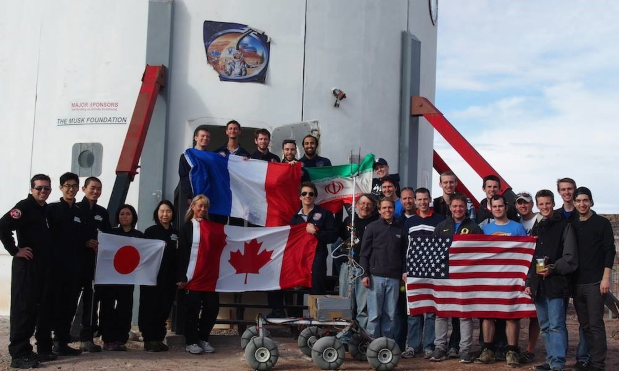
We first drove to the cowboy corner to park the rovers. Then we started the walk in direction of Tharsis Montes while passing by the canyon. Thomas made radiation measurements in the canyon with the help of Antoine to complete his study. The measurements in the canyon did not exceed 15 counts per second, so it was only the background that we measured; no isotope found. Augustin and Gwenael worked to complete the mapping for Augustin’s program.The mapping of the area by the drone was a success. The first data exports are promising and will be processed in the coming days. The pooling of radiation and drone data is therefore less interesting for this time As we were efficient and finished a bit early, Gwenael took the opportunity to make a photo shoot to thank our sponsors at the end of the EVA.
Destination: Canyon north of Tharsis Montes.
Coordinates (use UTM WGS 84): 519000 E, 4254000 N
Participants: Antoine (EVA Leader)(Commander), Thomas ( Scientist ), Gwen ( astronomer ) , Augustin ( GHO )
Road(s) and routes per MDRS Map: Cow Dung Road 0110
Mode of travel: driving to Cowboy Corner then walking to the canyon north of Tharsis Montes.

EVA #11
Author : Ttele Hiriart, Crew Health and Safety Officer
Purpose of EVA:

During SOL 3, the Kissing Kamel Ridge W has been mapped extensively. After reprocessing the images, some interesting areas have been found for the purpose of the GHO’s experiment. We discovered some cavities that could protect humans from radiation. After making some measurements on the 3D model, Augustin needed to check the efficiency of his model by making the same measurements on the field. Ttele was there to help with measurements and GPS data.
Agnès could thus see if some microorganisms could be living in those cavities, protected from the radiation, and compare them with microorganisms exposed to the radiation on the same field. This will add some credit to her experiment about extremophiles and their resistance to radiation. Their viability could then be compared to microorganisms actually living on Mars.

Start time : 14:05 pm
End time : 16:49 pm

Narrative :
This afternoon, after a good meal, we got prepared for the EVA with Augustin and Agnès. With the clouds the weather was not as hot as expected. We took the two rovers and drove to Camel Ridge. We walked to go to the place we went last time. On the way we found two other caves that we measured and took pictures of. They were big enough to squeeze in and hide if necessary. That is why, we made two mappings with the drone, to be able to complete the map we started last time we came.
Arriving at the place we visited last time, we matched the mapping with the cave Augustin noted last time, and verified the measures. Agnès took some stone and earth samples to see if she could find some microorganisms on them. If she finds some, she will compare them with microorganisms exposed to the radiation in the same field. At the same time, I was helping with the drone and making sure we didn’t lose it this time. I also helped Augustin with his measurements and Agnès to carry her samples.
From the top, we noticed some Martians visiting the area. We were lucky to find some animal footprints again. We also saw two big black birds, but couldn’t say which breed they were, because we were too far. When we finished to map, we came down, took the rovers and arrived at 16h47, parked the rovers and came back into the hab. Another successful EVA.

Destination: Kissing Kamel Ridge W
Coordinates (use UTM WSG 84): 518000 E, 4249500 N
EVA Participants: Ttele (EVA Leader) (HSO), Augustin (GreenHab), Agnès (XO)
Road(s) and routes per MDRS Map: Cow Dung Road 0110
Mode of travel: Driving to Kamel Ridge then walking around no further than 300m

EVA Report – April 11th

Crew 279 Operations Report 11-04-2023
SOL: 9
Name of person filing report: Ioana Dimitrova

Non-nominal systems: robotic observatory, Opportunity
Notes on non-nominal systems:
Robotic observatory: awaiting for a solution from the manufacturer.
Opportunity Rover : see rover section

ROVERS

Spirit rover used: no

Hours: 228,5

Beginning charge: 100%

Ending charge: 100%

Currently charging: yes

Opportunity rover used: yes

Hours: 120,2

Beginning charge: 100%

Ending charge: 81%

Currently charging: yes

Curiosity rover used: no

Hours: 215,5

Beginning charge: 100%

Ending charge: 100%

Currently charging: yes

Perseverance rover used: yes

Hours: 260,6

Beginning charge: 100%

Ending charge: 80%

Currently charging: yes

General notes on rovers: one of the battery wires on the driver side of Opportunity is corroded out and needs to be replaced.

Summary of Hab operations: Music influence on stress experiment was conducted. 3D print of Lunaria One, regolith collector. Team Building exercise.

WATER USE: 19,51

Water (static tank): 308,3

Static tank pipe heater (on or off): off

Static tank heater (On or off): off

Toilet tank emptied: no

Summary of internet: used from 14:00 to 21:00 for experiments and reports.

Summary of suits and radios: Radios charging nominal. Suits charging nominal.

Summary of GreenHab operations:

WATER USE: 17,9

Heater: Off

Supplemental light: Off

Harvest: none

Summary of ScienceDome operations : End of editing of mid-mission video.

Dual split: Heat or AC, Off

Summary of RAM operations: none

Summary of any observatory issues: see above for robotic observatory. New Mexico observatory used for M51. Photos are not usable because they are not tracked. See Observatory report.

Summary of health and safety issues: More nose bleeding. No more fever. See HSO report.

Questions, concerns and requests to Mission Support:

I only now notice that there is a mistake in Operations Report SOL 8, we inverted the data for Curiosity and Spirit as we confused both because we didn’t park them at their usual spot. Also we misread 215,5 for 215,9 hours for Curiosity (which we named Spirit by mistake in the report). The data in this report is all correct.

EVA Report – April 11th

Crew 279 EVA Report 11-04-2023
EVA #10
Author : Gwenaël le Bussy, Crew Astronomer
Purpose of EVA:
The goal of today’s EVA was to check out bacteria samples from Agnes in North Ridge that we placed there 4 days ago. We needed to check that everything was in good condition. These checks are essential to ensure the accuracy and success of Agnes’ research project. This was Agnès’ last check and her next EVA will be to recover her bacteria.
Then, Gwenael had to take advantage of the light morning wind and his presence in North Ridge to pilot the drone and report on Agnes’ experience. These drone shots will be useful to understand the environment and the conditions where Agnès put her bacteria. Ttele’s presence was essential to keep an eye contact with the drone during the report.
Start time: 8:08 am
End time: 10:54 am
Narrative:
First, we went to North Ridge ; both rovers started the trip with 100% battery. The ride was smooth and without any problem.
Arriving at the base of North Ridge, the EVA crew started climbing towards the top by the south side of the mountain. During the ascension, Ttele used the drone to report the climb under Gwen’s supervision.
On top, Agnès checked all bacteria samples ; the samples are in good condition and no samples are missing. We noticed little bacterial growth but we won’t be sure until SOL11 when Agnès will finally retrieve the samples and analyse them in the MDRS.
During this time, Gwenaël and Ttele performed the mapping of North Ridge’s top to document the environment where the bacteria grew. In fact, this was an opportunity to kill two birds with one stone : all the information is useful for Agnès’ bacterial experiment but also for Augustin’s mapping of the surroundings of MDRS. The mapping went smoothly and we had the chance to cover a wide area. For the last hour of this EVA, Gwen attempted to connect the drone a last time to make some video reports. Sadly, we failed to connect the drone and had to come back to the rovers at 10:30 AM.
The crew made it back safely to MDRS at 10:54 AM.
Destination: North Ridge
Coordinates (use UTM WGS 84): 518500 E, 4251750 N
Participants: Gwen (EVA Leader)(Astronomer), Ttele (HSO), Agnès (Crew Executive Officer)
Road(s) and routes per MDRS Map: Cow Dung Road 0110
Mode of travel: Drive to North Ridge then walk on top of it.

EVA Report – April 10th

Crew 279 EVA Report 10-04-2023
EVA #9
Author: Thomas Stinglhamber, Crew Scientist
Purpose of EVA:

The EVA was the sequel to EVA #3 for Thomas’ experiment. He had to take radioactivity measurements near the base with his detector. He made punctual measurements of radioactivity (gamma emission) every 10 meters. The area was vast, so he aimed to do as many measurements as possible, targeting 100-150 measurements. He followed a snake-like route: North (250m)-West (10m)-South (250m)-West (10m)-North (250m), and so on. During EVA#3, he had taken measurements from the East of the Hab, and this time, he was covering the West part.
It had been difficult to make measurements with only one person for support during the last EVA, so he was helped by Antoine and Aglaé, who took notes and guided him in his tracing with the help of GPS.

Start time: 8:15 am
End time: 10:13 am
Narrative:
The day was likely to be very hot, so we began the EVA an hour earlier than usual to avoid exposure to the sun at its peak. The crew had to wake up early to prepare for an 8 am start. This was already the first difficulty. The second difficulty was the preparation of pancakes by Thomas and Antoine for the rest of the Crew… Fortunately the 2 difficulties were passed successfully.

Despite the precaution of getting up earlier to avoid the heat, taking radiation measurements for Thomas’s experiment around the base was difficult due to the hilly terrain and intense heat that began as early as 9:30 a.m. However, they persevered and managed to complete the EVA successfully. They made more than 140 measures which almost completed the planned map. In fact, they were so efficient that they even had time to capture drone footage of the station.

Destination: Mars Desert Research Station (MDRS)
Coordinates (use UTM WGS 84): 518200 E ,4251000 N
Participants: Thomas (EVA Leader, Scientist), Antoine (Commander), Aglaé (Journalist).
Road(s) and routes per MDRS Map: None
Mode of travel: By foot

EVA Report – April 9th

Crew 279 EVA Report 09-04-2023
EVA #7
Author : Ioana Dimitrova, Crew Engineer
Purpose of EVA:
The purpose of the EVA was to check out the weather balloon and bacteria samples from Agnes in North Ridge that we put in on SOL 5. We needed to check that everything is in good condition and download the data from the arduino to analyze it in more detail. These checks are essential to ensure the accuracy and success of Agnes’ research project. It was necessary to inflate the helium balloon and therefore carry the tanks to the top of North Ridge, Ioana and Ttele were there as support.
Start time: 9:10 am
End time: 10:45 am
Narrative:
At 9:10, the three astronauts opened the door of the Hab airlock and took Opportunity and Perseverance for a drive along Cow Dung Road 0110. We parked our rovers at the left side of the road on the right side of the North Ridge, exactly where we left them at SOL 5. We climbed North Ridge quickly without problems by the same route we took last time, carrying the helium tank. We got to the top at 9:38 am. Upon arrival, we couldn’t see the weather balloon in the air and started searching for it on the ground by following the rope it was attached to. After following and untying the rope from several rocks, we retrieved the balloon. Sadly, the balloon had fallen to the ground due to a lack of helium and had a small tear in it surely from a rock or plant it had passed through. So blowing new helium in it had no sense. We untied it and took it home with us. The Arduino attached to it was also impacted by the impact of the balloon on the ground. Agnes was a bit disappointed but still happy she tried. She checked her bacteria which seemed to be in a good condition. We left them there as they won’t be analyzed until Sol11. We added a new information sign to the experiment which explained what the setup was and why people should not touch it. At 10:20, we were done with our tasks and headed down the ridge. We took our rovers at 10:38 and arrived at base on time.
Destination: North Ridge
Coordinates (use UTM WGS 84): 518500 E, 4251750 N

Participants: Ioana (EVA leader)(Crew Engineer), Agnes (XO), Ttele (HSO)
Road(s) and routes per MDRS Map: Cow Dung Road 0110
Mode of travel: Drive on Cow Dung Road 0110 to North Ridge then walking on the top of North Ridge.

EVA: # 8
Author: Augustin Tribolet, Crew GreenHab Officer
Purpose of EVA: Augustin wanted to map a Canyon for the first time. Some interesting areas protected by radiation can indeed be found in the canyon since the water dragged the rocks. The clief of both sides give a natural shield for radiation on Mars or even better cavities can be present. With the 3D map reconstructed, Augustin will see if we can refind with the 3D map reconstructed, the most protected area found onsite during the EVA. This protected region can be useful for astronauts themself to implement bases on Mars or to find life on Mars, such as extremophiles (studied by Agnès). This time it was Ioana’s turn to always have an eye on the drone to avoid a potential new crash.
Start time: 14:00
End time: 17:00
Narrative:
For the GHO’s experiment, the canyon Candor Chasma has been mapped for the first time during this EVA. The 3 crew members drove with the rovers and arrived at their destination at 14:38. The EVA started with an analysis of the terrains, some interesting areas protected from radiation have been identified inside the Canyon. Then, the drone has been deployed and launched to map regions including these identified targets. A total of four different scans were conducted, one at the entrance and three inside the canyon itself.
Due to some loss of data in the previous drone missions, Agnès and Ioana have also been trained to use the drone. They have first learned how to take off, guid the drone, perform basic commands and finally land. Then, they have learned how to scan a zone for the purpose of photogrammetry, which means programming the application controlling the drone with the good parameters (to map and keep the drone safely in the field of view). In this way, they will be able to use the drone to map some region in their next EVA for the purpose of the GreenHab Officer’s experiment.
The EVA Crew was back at the Hab at 17:00. The objectives of the EVA were completed, interesting regions were found and will be processed and analysed with the computer.
Destination: Candor Chasma
Coordinates (use UTM WSG 84): 521500 E ,4251000 N
EVA Participants: Augustin (EVA Leader, GHO), Ioana (Engineer), Agnes (XO)
Road(s) and routes per MDRS Map: Cow Dung Road 0110 and Galileo Road 1104
Mode of travel: Drive on Cow Dung Road 0110 then Galileo Road 1104 to Compass Rock then walking to Candor Chasma.

EVA Report – April 8th

Crew 279 EVA Report 07-04-2023

EVA # 5
Author: Ttele Hiriart, Health and safety officer

Purpose of EVA:
This EVA was useful for 2 experiments:

Crew Scientist’s experience:
Like the measurements he made near the base, this time he focused on a particularly old area with a lot of fossils. Thanks to a scintillator, he performed occasional measurements of radioactivity (gamma emission). The area was vast to cover, he focused particularly on the fossils present but also measured the soil and took samples (only soil, not fossils). He was helped by Antoine who noted and guided him.

GreenHab officer’s experience:
As the drone unfortunately crashed the last time, Augustin maped a canyon. He took advantage of going out with Thomas to map an area of interest that is “Special Region”. As the drone crashed, Ttele supported him to help Augustin to see the drone and avoid a second crash.

The main objective of this EVA was therefore to pool Augustin’s maps and Thomas’ radioactivity measurements to create a 3D map of the activity and we thought it was an interesting region for mapping and for measurements of fossil radioactivity. They are parts that are old and therefore normally have a low radiation rate (like C11). We tried to see the difference with the measures taken with loana from Hab.

Start time: 9h08
End time: 12h39

Narrative :

This morning, we woke up with good energy. After a nice breakfast, the EVA team got prepared, with all the material we needed for the two experiments of Thomas and Augustin.
We went out of the sass at 9h08 and got to the rovers Cury and Spirit. We drove until the destination without a problem, meeting different kinds of martians on their big trucks. They were very curious about us. We lost contact with the hab after north ridge.
We arrived at the Special Region at 9h36, parked the rovers and started walking. We all went into the canyon, looking for places for the measurement of Thomas, and a good place for the drone to start flying. Thomas found several corners where the radiation datas were interesting, mostly in the ground of the canyon. Augustin managed to make a first 11 min flight with the drone, to make a video of the first area he needed. Then, we realized there were small caves, or recesses in the wall. We then mapped these places and took pictures to compare them.
We managed to join Thomas and Augustins experiments, by using different key points in the map. This made possible the matching of their information for the 3D cartography. The drone functioned very well, responding to the application as expected.
We walked in the canyon or above, during most of the time of the EVA according to Augustin’s and Thomas plans. Antoine helped Thomas for his mesures, and I supported Augustin with the drone, carrying the material and making sure the drone is always visible.
After a turning in the canyon, the narrowness of the place was replaced by a very big landscape. With a lot of luck, Thomas found a very big fossil of an old tree, stuck in the wall of the canyon. He made several measures and realized that the radiation of the fossil was higher than expected. He noted the radioactivity as mid-high, with the techniques of count rate.
We were very excited about it, and felt very lucky to witness such an old part of the earth.
After all these adventures, we went back to the rovers. At 12h07, we started to come back to the base. We met other Martians again, but they didn’t look very surprised to meet us.
We got in contact with the base again, and arrived at the hab, checked the rovers and took all our material and at 12h39 we got into the airlock.
At 12h44 we got out of it, and with the help of our crew mates that stayed in the hab, we took out all the equipment.
We were very happy with this EVA and very excited to explain our discoveries to the rest of the team.

Destination: Special Region
Coordinates (use UTM WSG 84): 518200 E ,4256000 N
EVA Participants: Ttele (EVA Leader) (HSO), Antoine (Commander), Augustin (GreenHab), Thomas (Scientist)
Road(s) and routes per MDRS Map: Cow Dung Road 0110
Mode of travel:
Drive to the cross of Cow Dung Road 0110 and Gateway to Lith then walking to the Special Region.

EVA Report – April 9th

Crew 279 EVA Report 07-04-2023

EVA # 5
Author: Ttele Hiriart, Health and safety officer

Purpose of EVA:
This EVA was useful for 2 experiments:

Crew Scientist’s experience:
Like the measurements he made near the base, this time he focused on a particularly old area with a lot of fossils. Thanks to a scintillator, he performed occasional measurements of radioactivity (gamma emission). The area was vast to cover, he focused particularly on the fossils present but also measured the soil and took samples (only soil, not fossils). He was helped by Antoine who noted and guided him.

GreenHab officer’s experience:
As the drone unfortunately crashed the last time, Augustin maped a canyon. He took advantage of going out with Thomas to map an area of interest that is “Special Region”. As the drone crashed, Ttele supported him to help Augustin to see the drone and avoid a second crash.

The main objective of this EVA was therefore to pool Augustin’s maps and Thomas’ radioactivity measurements to create a 3D map of the activity and we thought it was an interesting region for mapping and for measurements of fossil radioactivity. They are parts that are old and therefore normally have a low radiation rate (like C11). We tried to see the difference with the measures taken with loana from Hab.

Start time: 9h08
End time: 12h39

Narrative :

This morning, we woke up with good energy. After a nice breakfast, the EVA team got prepared, with all the material we needed for the two experiments of Thomas and Augustin.
We went out of the sass at 9h08 and got to the rovers Cury and Spirit. We drove until the destination without a problem, meeting different kinds of martians on their big trucks. They were very curious about us. We lost contact with the hab after north ridge.
We arrived at the Special Region at 9h36, parked the rovers and started walking. We all went into the canyon, looking for places for the measurement of Thomas, and a good place for the drone to start flying. Thomas found several corners where the radiation datas were interesting, mostly in the ground of the canyon. Augustin managed to make a first 11 min flight with the drone, to make a video of the first area he needed. Then, we realized there were small caves, or recesses in the wall. We then mapped these places and took pictures to compare them.
We managed to join Thomas and Augustins experiments, by using different key points in the map. This made possible the matching of their information for the 3D cartography. The drone functioned very well, responding to the application as expected.
We walked in the canyon or above, during most of the time of the EVA according to Augustin’s and Thomas plans. Antoine helped Thomas for his mesures, and I supported Augustin with the drone, carrying the material and making sure the drone is always visible.
After a turning in the canyon, the narrowness of the place was replaced by a very big landscape. With a lot of luck, Thomas found a very big fossil of an old tree, stuck in the wall of the canyon. He made several measures and realized that the radiation of the fossil was higher than expected. He noted the radioactivity as mid-high, with the techniques of count rate.
We were very excited about it, and felt very lucky to witness such an old part of the earth.
After all these adventures, we went back to the rovers. At 12h07, we started to come back to the base. We met other Martians again, but they didn’t look very surprised to meet us.
We got in contact with the base again, and arrived at the hab, checked the rovers and took all our material and at 12h39 we got into the airlock.
At 12h44 we got out of it, and with the help of our crew mates that stayed in the hab, we took out all the equipment.
We were very happy with this EVA and very excited to explain our discoveries to the rest of the team.

Destination: Special Region
Coordinates (use UTM WSG 84): 518200 E ,4256000 N
EVA Participants: Ttele (EVA Leader) (HSO), Antoine (Commander), Augustin (GreenHab), Thomas (Scientist)
Road(s) and routes per MDRS Map: Cow Dung Road 0110
Mode of travel:
Drive to the cross of Cow Dung Road 0110 and Gateway to Lith then walking to the Special Region.

EVA Report – April 7th

Crew 279 EVA Report 07-04-2023

EVA # 5

Author: Agnès Dekeyser, Crew Executive Officer

Purpose of EVA:

EVA will be focused on conducting a number of experiments that will help us better understand the conditions on Mars. The crew will be exposing bacteria to the MDRS environmental conditions and comparing the results with their analog staying inside the MDRS. This will give us valuable insights into how microorganisms react to the harsh Martian environment and how we can potentially use this knowledge to support future human exploration of Mars.

Additionally, we will be launching a meteorological balloon to take some measurements of atmospheric pressure and temperature. These measurements will help us to better understand the weather patterns on Mars and how they may impact future missions to the planet.

Finally, we will begin our reportage with the parameters tested during the previous EVA. This will allow us to document our findings and share them with the scientific community back on Earth.

Support will be necessary for the installation of the balloon and especially the inflation of it. Which increases the number of people needed to 4.

Start time: 9h06

End time: 11h54

Narrative:

The crew began their journey with a sunny day and a lot of material to carry. Once everything had been loaded into the rovers, the crew drove to their mission destination. Once at North Ridge they had to wait a bit before beginning their mission because of the presence of Martians at the place of their stop. Once the Martians left the place, the crew began their ascent. They walked a little bit all around the North Ridge to find the best way to arrive at the top.

Once at the top, bacteria in their cuvette were placed at the more suitable place to stay for several days. They were attached to a rack with a sign mentioning “Please do not touch”. After that, the cuvettes were oriented to face the sun at any time of the day. One big rock was also placed on top of the rack to make sure that it won’t move during the next few days of exposure to Mars environmental conditions.

Several pictures were taken during the brave ascension of the crew with the heavy material. Once at the top, the crew took a few minutes to observe the view and take pictures despite the short time available due to the work needed to launch the meteorological balloon.

Then, the most ambitious part began : the meteorological balloon was filled with helium and closed very carefully as explained by the manufacturer. One martionaut was holding the balloon while the others were closing the opening using a colson. The latter were covered by tape to prevent them from scratching the ball. The cord was then attached to the opening with several nodes. The opening was folded in two and closed again using colson and tape. The sensor was then attached using the same cord and the balloon was dropped in the air. Some videos and pictures of the launching were taken for the reportage.

Bacteria and the balloon with the sensor attached to it will stay there until the next visit in two days to collect data and check bacteria.

The crew climbed down and took some pictures again before picking up the rovers. Once at the MDRS, they reported the parameters of the four rovers and made a last video of the entry of the crew in the airlock for the reportage.

Destination: North Ridge, because this is the place that the authorities (Utah Division of Aeronautics) have granted us to place our balloon.

Coordinates (use UTM WGS 84): 518500 E, 4251750 N

Participants: Agnès (XO, EVA Leader), Ioana (Engineer), Aglaé (Journalist), Gwen (Astronomer)

Road(s) and routes per MDRS Map: Cow Dung Road 0110 to the cross with Gateway to Candor

Mode of travel: Driving on Cow Dung Road 0110 to the cross with Gateway to Candor then walking to the North Ridge.

EVA Report – April 6th

Crew 279 EVA Report 06-04-2023

EVA #4

Author : Gwenaël le Bussy, Crew Astronomer

Purpose of EVA:

After testing the 2 software for Augustin’s drone, he chose one. To test how the drone reacts to relief, he intends to go to Kissing Camel Ridge to do a mapping of 250m by 229m at low altitude. This place will serve as the first test for low altitude flight. Then he will go to White Rock Canyon where he will do the same thing but with relief on both sides. This time the map will be 250m by 310m. The drone will make a first flight between 20 and 50 meters above sea level to map any obstacles and then a second flight at low altitude. He will need support to launch the drone and to always have a visual view of the drone when Augustin sees the view of the drone through his phone.

The experiment is to see how a drone can be useful to find regions protected from radiation (either for extremophile bacteria or for astronauts themself). To do this, Kissing Camel Ridge W gives a good area with a lot of relief. Then canyon in general can be an interesting place to look for since the water has dragged the rock and potentially offer cavities giving protected area from

Gwen will also test a new reportage camera and focus on obturation time. A fourth person will be needed as technical support, especially for microphone tests (If we hear well on Gwen’s camera). If all these tests are ok, they will start the report.

Start time: 9:13 am

End time: 12 am

Narrative:

First, we went to the Kissing Camel Ridge W (KCRW) ; beginning at 100% battery for both rovers, we ended up with 84% for Spirit and 85% for Curiosity for the 1.01 mile drive. Both rovers were on « M » drive mode and the drive was smooth without speeding. Such consumption seems strange to us and we have a few hypothesis for that behaviour :

Battery consumption is not linear and the first pourcentages are consumed faster
When the battery is « cold » the rover consumes more
Maybe driving mode should be switched to « F » for long distances.
Arriving at KCRW, Augustin started the mapping with the drone while Gwen was testing some settings for best audio and video for reporting. During the mapping, the drone crashed on top of KCRW and the EVA crew had to recover it ; with the approval of the Hab, we started ascending KCRW. Because of the terrain, the EVA crew had to pass by the South side of the KCRW to climb on top. This side of the ridge is in fact in the opposite way the Hab and we lost communication between members of the EVA. Gwen communicated the problem to the Hab then the EVA crew members switched to Channel 2 for communicating on the ridge. In fact, this choice cuts communication with the Hab and we had to inform them. We continued ascending the ridge, reached the top and found the crashed drone. Hopefully, the drone was reparable and Augustin was able to continue the mapping of KCRW.

On top, Gwen was able to communicate again with the Hab (by switching to channel 1) and transmitted all the necessary information to the EVA crew who stayed on Channel 2. Because of the crash, we lost a lot of time and decided with the Hab control to stay on KCRW for the all EVA instead of going to White Rock Canyon after. This allowed Augustin to finish the mapping of KCRW.

At 11:15 AM, the EVA crew decided to start the descent to the rovers by the same route as the climb to avoid risky choices and injuries. The crew returned in time to the Hab after reporting the parameters of the four rovers.

Destination: Kissing Camel Ridge W

Coordinates (use UTM WGS 84): 518000 E, 4249500 N

Participants: Gwen (EVA Leader)(Astronomer), Ttele (HSO), Antoine (Commander), Augustin (GreenHab officer)

Road(s) and routes per MDRS Map: Cow Dung Road 0110

Mode of travel: Drive for a first stop between Kissing Camel Ridge W and E then walking along side of the north face of Kissing Camel Ridge W. Then climbing on top of KCRW

EVA Report – April 5th

CREW 279 – Journalist Report – 05APR2023

Journalist Report – Aglaé Sacré, crew journalist
SOL 3: Mapping and radiation

This morning we had the chance to eat delicious pancakes with fruit and syrup! A real happiness to start the day!

The training ‘s EVA are over, we can get down to business. Two experiments were able to progress this morning.
The first one was our Crew scientist’s experiment. Thomas could start to take measurements of the radiation of the ground with his scintillator. With this instrument, he is looking for gamma emitting isotopes. He made a grid of points all around the base and he must go to every point and measure to complete his grid with data.

With his drone, Augustin started the mapping of the station. He was able to test two software programs to take images to see which one was best suited to the situation and the terrain. He then rendered these images in 3D via a process on another software.

After a long EVA, our 4 explorers were welcomed with a good plate of mac and cheese! A good way to refuel!

The afternoon was again reserved for personal experiments, Agnes was able to carefully select her colonies of bacteria, 6 colonies of each strain, which she put in a liquid culture medium before separating them into two groups.

The 3D printer is functional! We will be able to start printing tomorrow morning!

Unfortunately, the sun was not shining, and we could not observe it today, we cross our fingers to be able to see it soon.

In the evening each of us prepares his report to be ready to send it at 7 pm.
Ioana, our engineer, must check a series of measures for the good functioning of the station: water measurement, check of the walkie-talkies and the suits, management of the toilet…

Tonight, the kitchen team of the day will prepare a delicious omelet! After this good meal, the team will meet to share a board game all together to close the day.

Copyright © The Mars Society. All rights reserved. | Main Site