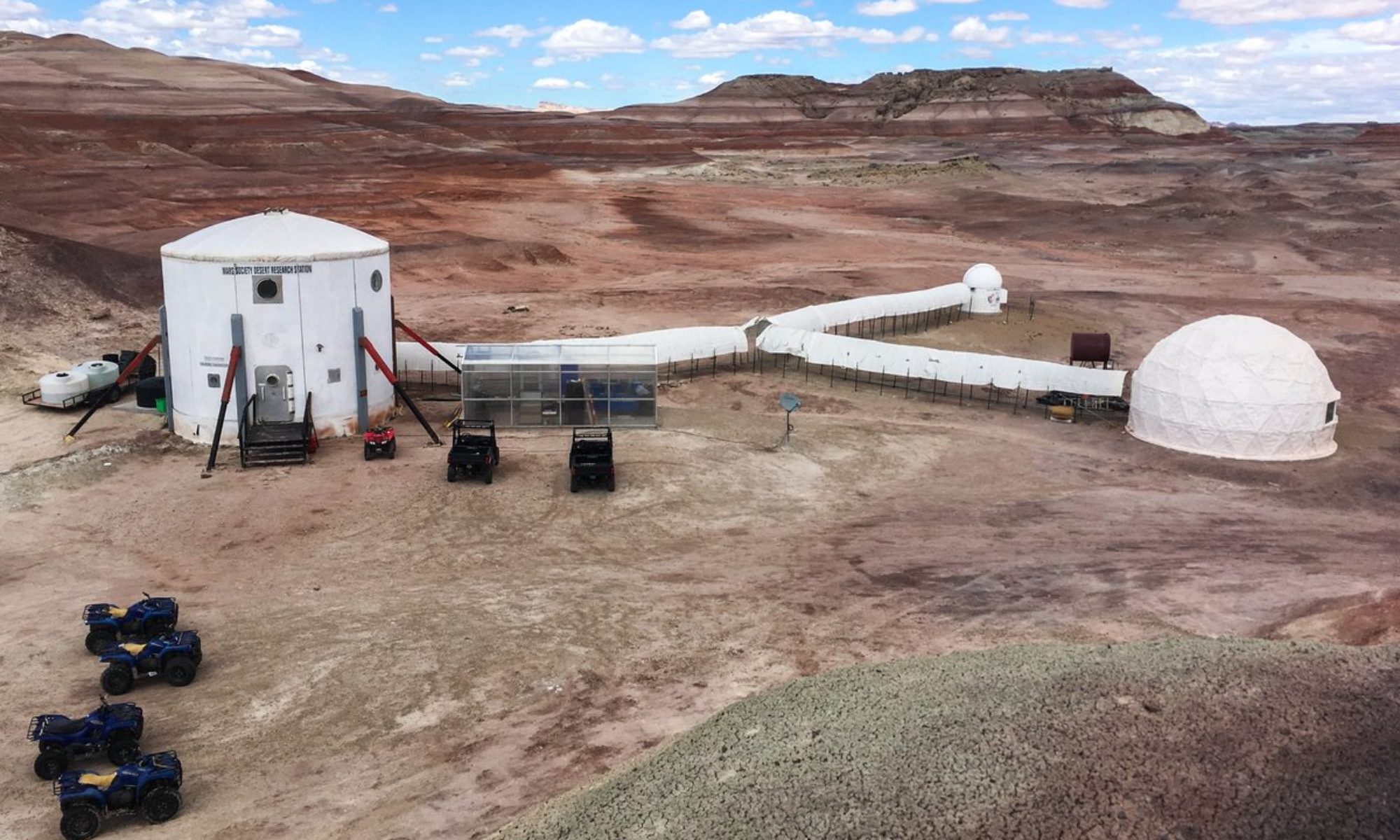

Crew 261 GreenHab Report 06-05-2023
GreenHab Officer: Cécile Renaud
Environmental control: Door open from 6:45 to 19:00
Average temperatures: 47.8°F at 07:00, 83,1°F at 13:20, 70,9°F at 19:00
Hours of supplemental light: N/A
Daily water usage for crops: 6 gal at 07:00 + 6 gal at 19:00
Daily water usage for research and/or other purposes: 1 gal (including watering solution for biostimulant exp)
Water in Blue Tank 99 gallons
Time(s) of watering for crops: 07:00 and 19:00
Changes to crops: N/A
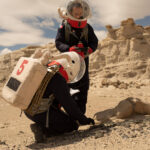
Narrative: 1 cucumber and some tomatoes has to be harvested, carrots will be harvested next week.
Harvest: (include which crop and mass in grams) : None
Support/supplies needed: None
EVA Report – May 6th
Crew 261 EVA Report 06-05-2023
EVA # 9
Author: Erin Kennedy (Crew Roboticist), (with inputs from HSO Audrey Derobertmasure)
Purpose of EVA:
1) Testing of Atmosphinder prototype mechanised wind sails and improved towing method
2) Testing of Atmosphinder prototype descending hill with steeper grade
Start time: 11:27 am
End time: 1:50 PM
Narrative:
Overview of EVA
Prior to EVA-9, the EVA crew members were given a briefing on the objective of today’s Atmosphinder experiments and the procedure.
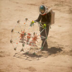
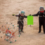
EVA-9 conducted Atmosphinder testing in the half-sized configuration (~1 m diameter) with sails (17″ x 28.5″) extending from the two hoops. The electronics were updated to include one sail trimming servo motor on each sail, and lights to indicate the trim position. The testing was divided into two sections: sail testing near the Hab and steeper grade hill testing near Phobos Peak. The robot and supporting parts were extracted from the RAM.
Sail testing took place in front of the Hab. The sail testing observed the performance of the trim motors with the gusts of wind. In all 3 positions and on both sides, the motors performed to specification. The force of the wind on the sail frame ranged from 2N to 9 N, as measured with force spring gauges. The reported wind speed was Wind – SSW 14 mph, Wind gusts – 33 mph. The wind on the sails was able to tilt the electronics payload bay to 30 degrees. This test built on learnings from EVA-6. The sail frame experienced rotation about the axis perpendicular to the bearing plate that the electronics payload bay mounts onto. This prevented further meaningful testing and experimentation from taking place. Limitations for the interaction with the electronics while in astronaut suits was noted.
The sails were uninstalled and returned back to the RAM. The robot (incl. electronics) was loaded into the Spirit rover in the same method as EVA-2, and securely fastened to the rover frame using the blue and grey tow rope from Curiosity (the tow rope was returned to Curiosity upon return). During the journey to the next location, the rover was stopped briefly to conduct a payload check after some bumpy portions, in order to ensure the robot was still secured in the rover. The journey continued while following a map to the point of interest destination.
Steeper grade hill testing took place in the vicinity of Phobos Peak, within close proximity to the road for transporting the robot. The rover was parked to the side of the road. The location was scouted on foot to determine the best hill. The candidate hill was approximately 2 meters tall, at an estimated 30 degrees grade. The robot was towed to the top of the hill while walking while keeping in mind astronaut safety.
The robot was given an initial push to roll down the hill. This was conducted to observe the dynamics of the robot structure given the terrain. With an enthusiastic ‘Bon Voyage’, the robot rolled down the hill with gusto! As the robot approached level land, similar to EVA-2, known weak pieces broke under the loads. The robot tipped over onto its side before coming to rest. Collecting the pieces was conducted in two trips. On the 2nd trip, the electronics payload was brought to retrace the steps to the launch point and resting point of the robot. This data will be used to determine the elevation and distance travelled. All pieces were collected.
The return to the Hab was completed with the Spirit rover. The robot was returned to the RAM. An initial damage analysis shows that it was not as destructive as it had appeared to be in the field. The repaired pieces from EVA-4 held up well.
EVA-9 built on the lessons learned previously as well as the pertinent safety training received yesterday. The EVA-9 resulted in new information being learned that would only be possible in this unique environment. Many thanks to the entire crew — both on the EVA, at HabCom, and behind the scenes!
Both EVA crewmembers carried a Meshtastic device to gather data for that project. Audrey managed the Garmin devices and sent points of interest as planned.
Issues Experienced During EVA-9
[Procedural] There was a wrong turn taken upon return, but quickly noticed (within 20 seconds), rerouted, and communicated back to Hab
[Technical] There was a longer than anticipated delay in the Garmin InReeach transmitting the Point of Interest
[Procedural] Some crew members struggle to press the PTT button reliably and timely
[Procedural] HabCom told crew to take Spirit when the final request had Curiosity and Perseverance (per Mission Support’s advice). This was compounded the later EVA which had Spirit in the request but that rover had already been used on this EVA so could not be taken.
Outcomes
When removing helmet to take a drink of water for safety, kneeling down is easiest.
In-situ scouting is needed for regions of interest to supplement the map and satellite view. MarsVR could greatly assist with this.
New information acquired for Atmosphinder robot experiment
New information acquired with electronics running environmental sensor data logging
Destination:
In front of Hab (518100 E, 4250900 N)
Hill within Phobos Peak Vicinity (518200 E, 4249991 N)
Coordinates (use UTM WGS 84): See above
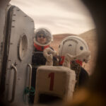
EVA Participants: 3: Audrey Derobertmasure (EVA Leader), Erin Kennedy (Crew Roboticist), Kris Davidson (Journalist) (Not In Sim – Not Wearing Suit)
Road(s) and routes per MDRS Map:
Drive from Hab, Turn right, Go South on Cow Dung Road
Park rover near: 518100 E, 4250050 N
Walk around to scout locations (~250 m)
Walk to chosen hill (~80 m)
Walk back to parked rover (~80 m)
Drive to Hab – Go North on Cow Dung Road, Turn Left
Mode of travel: Rover and Walking
Vehicles you will be using (If applicable): Rover (Spirit)
Crew 261 EVA Report 06–05–2023
EVA # 10
Author: James Burk, Commander
Purpose of EVA: Drone Rescue + Reconnaissance of area leading up to Sommerville Overlook.
Start time: 3:00 PM
End time: 6:00 PM
Narrative:
Overview of EVA
The goal of this EVA was to retrieve the wayward Icarus drone and, afterward, to head up to a scenic place to fly it. Commander Burk had visited Candor Chasma on the last EVA of Crew 197 in 2018 and was eager to return and to see it from different angles. Successfully reaching Sommerville Overlook with one or both rovers would also demonstrate our crew’s ability to successfully reach comparable objectives.
Commander Burk and GreenHab Officer Renaud took out Opportunity and Curiosity (respectively) and successfully reached the same location that Commander Burk and XO Decadi had parked the previous day, just southeast of Compass Rock. They then proceeded on foot due South, following Watney road for 0.7 km until they reached the location of the Icarus drone. GreenHab Officer Renaud sighted it first, and thus had the honor of retrieving it. It was in excellent condition, as expected. The EVA team then hiked 0.7km back to the rovers.
Afterwards, the 2-rover caravan searched a bit for the exact stretch of Galileo Road that winds east-northwest from that point, and had some difficulty. They first backtracked north, then eventually located the road by surveying the area on foot for a few minutes. They then proceeded along Galileo Road for around 1/2 a kilometer when Commander Burk’s rover got slightly stuck in the sandy path of that stretch of Galileo Road. After exiting the rover and touring the area (with the expectation that they would be turning around at that point due to a hazardous road, GreenHab Officer Renaud suggested using 4-wheel drive along with digging out the front and back driver’s side wheels. Once those two things were done, the rover was almost instantly unstuck and the team continued their trek along Galileo Road, and reached the Sommerville Overlook.
After taking some photos, sending some Garmin waypoints, and also sending a Whatsapp message to the rest of the crew, the team then returned back to base, only stopping a few times for Comm checks and to take photo/video of the scenery.
The EVA went very smoothly overall, with excellent communication between the two EVA crewmembers. They also created a hand signal system to communicate when to switch between 4-wheel and 2-wheel drive during the traverse, which was extremely effective.
The EVA team returned late (see Issue below) but otherwise was safe and in full communication with each other throughout the EVA. HabCom did not always have radio communication, especially when the EVA team was far away on Galileo Road towards Sommerville, but always knew the location of the EVA team within a 5-10 minute delay and so were never concerned about their safety.
Back at the Hab, Mission Support contacted HabCom after the planned EVA window had past and expressed concern that HabCom was not in active radio communication at that point. Once Commander Burk had returned the Hab, he radioed Mission Support and explained that they had underestimated the overall time window for a successful traverse to Sommerville. There wasn’t much that could be done about the radio communication, but again, HabCom had been receiving regular and frequent updates via the Garmin waypoints and other non-radio communications received (Whatsapp).
Issues
[Procedural] EVA window was mis-estimated. It should have been a 2.5 or 3 hour EVA just to be sure, since it contained a lot of travelling including the hike down the Icarus drone.
[Technical] Channel 1 on the radios was very unreliable overall, so the EVA Team mostly stuck to channel 2 when speaking to each other. They still frequently switched to channel 1 and gave verbal reports which were never heard by HabCom until they were almost back at the Hab, and in one case when the Hab was in visual sight (albiet far away) during the return traverse on Galileo Road.
Outcomes
Hand signals for switching between 2-wheel and 4-wheel drive are very useful and effective in a 2-rover convoy when roads require it.
We need to write down the beginning and end of EVA times because we keep having to forensically analyze them after the fact instead of just logging it with the other EVA data (rover hours/SOC, etc.)
Having 2 rovers for long EVAs is a good idea for Safety.
We need more repeaters across the map!
Destination: First to Downed Icarus Drone, then onto the road leading to Sommerville Overlook, depending on Rovers’ range.
Coordinates (use UTM WSG 84):
Downed Icarus Drone: 519900 E, 4251800 N
Sommerville Overlook: 522000 E, 4253000 N
EVA Participants: 2: James Burk (Commander) (EVA Leader), Cecile Renaud (GreenHab Officer)
Road(s) and routes per MDRS Map: Drive to Cow Dung Road, then North to Galileo Road, then East/SouthEast to Compass Rock, then the location of the downed Icarus drone. After retrieving the drone, go Northeast on Galileo Road and drive as far as rovers’ allow, up to Sommerville Overlook. Walk on foot to explore area.
Mode of travel: Rovers (Curiosity and Opportunity).
Supplemental Operations Report – May 6th
Supplemental Operations Report 06May2023
Name of person filing report: Sergii Iakymov
Reason for Report: Routine.
Non-Nominal Systems: Robotic observatory.
Action taken for non-nominal systems: New parts for Robotic observatory are received and scheduled to be installed during Crew 261 rotation.
Power system:
Solar: nominal. Input breaker of one of MPTT was tripped several times this week. After resetting the breaker and solar charger controller current work is nominal.SOC Last 24 hours: Max 100%; Min 65 %; Avg 77.3%.
VDC Last 24 hours: Max 58.99V; Min 45.69; Avg 51.66V.Generator run time: about 12am – 6am on May 4-5th. Generator hours 3787.4.
Propane Reading Station Tank: 75%
Propane Reading Director Tank: 60%
Propane Reading Intern Tank: 71%
Propane Reading Generator Tank: 76%
Water (Static Tank) – 289 gallons
Water in GreenHab – 99 gallons
Water (Outpost tank) – 275 gallons
Water in Science Dome: 0 gallons
Hab Toilet Tank emptied: n/a
Sojourner rover used: No.
Hours: 191.7
Beginning Charge: 100
Ending Charge: 100
Currently Charging: Yes
Notes on Rovers: All are plugged in, charged.
ATV’s Used: (Honda, 350.1, 350.2, 300): None
Reason for use: n/a
Oil Added? No
ATV Fuel Used: 0 Gals
Ethanol Free Gasoline — 0 Gallons
# Hours the ATVs were Used today: 0
Notes on ATV: All parked at the outpost and awaiting to be taken to service.
HabCar used and why, where? Yes. To Hanksville for water runs and supplies pick up.
Crew Car used and why, where? No. In Grand Junction.
General notes and comments: Nominal.
Dual Split in Science Dome: off due to warmer weather.
Summary of Internet: Nominal
Summary of suits and radios: Headset #3 was replaced.
EVA COMMS: Nominal
Campus wide inspection, if action taken, what and why: nothing to report
Summary of General Operations: All nominal.
Summary of Hab operations: Nominal.
Summary of GreenHab Operations: Nominal, heater turned off.
Summary of SciDome Operations: Nominal.
Summary of any Observatory Issues: New parts for Robotic observatory are received and scheduled to be installed during Crew 261 rotation .
Summary of RAM Operations: Nothing to report
Summary of Outpost Operations:
Director’s trailer – small leak was found in hot and cold water line of the bathroom sink. It is very minor and in the L shape connection right under the floor, it can be seen from the storage compartment. It does not require immediate actions but should be taken care of in the future.
Summary of Health and Safety Issues: Nominal.
Questions, Concerns, Supplies needed and Requests: Nothing to report
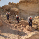
Crew Photos – May 5th


Sol Summary – May 5th
Crew 261 Sol Summary Report 05-05-2023
Sol: 5
Summary Title: First long-range EVA
Author’s name: Aline Decadi, XO
Mission Status: nominal
Sol Activity Summary: Today took place 2 EVAs:
– EVA-7 with the following crew members: James Burk (Commander)
(EVA Leader), Aline Decadi (XO).
– EVA-8 with the following crew members: Julien Villa-Massone (EVA Leader), Kris Davidson (Crew
Journalist), Audrey Derobertmasure (HSO).
EVA-7 conducted EVA with the following purposes:
Test of drones at Compass Rock.
Build experience for longer-range EVAs.
HabCom training of crewmembers to support longer-range EVAs.
We drove with Curiosity rover to Compass Rock with intermediate points: drive to Cow Dung Road, then North to Galileo Road, then East/SouthEast to Compass Rock. Walk on foot to explore the area.
We took time to find the right turn on Galileo Road. The MDRS Map seemed not reliable enough: the GPS was pointing the right turn at 4252200 while the map was indicating 4252000. As a lesson learnt from this experiment, we concluded that the map shall not be used as a reliable tool while navigating in exploration areas, but rather as an indicator. The good solution is to focus on a detailed preparation upfront (using satellite imaging to visualize the shape of the road) combined to the use of navigation devices on the field.
Another outcome from this EVA was that the SOC of the Curiosity rover decreased in a non-predictive way: in ten minutes, it decreased very quickly from 100% to 85%, then it stays at 66% for a very long time. As a lesson-learnt, it could be useful to test the rover under 60% in the vicinity of the MDRS station (for safety purpose) to predict the SOC. This could help to learn/ predict if the SOC goes very fast from 60% to 40% or even 20% or if it stays stable for a certain time around 50%-60%; and what are the parameters that can influence the SOC while in a long-range EVA. As the battery consumption may be different for each rover, we would recommend performing this test on the 4 rovers and provide the results to the mission support.
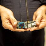
The Atmosphinder electronics payload was included on EVA-7. The air quality monitor was added, which reports PM 2.5, PM 10, and NH3 every 10 seconds. This sensor data, along with the pressure, humidity, temperature, wind (anemometer), GPS, and battery, was logged at 1 Hz to the microcontroller’s micro sd card. The data will be analysed at a later date. Progress on Atmosphinder including adapting and installing both sail assemblies, affixing an improved towing method, and coding the mechanised sail trim motors.
EVA-8 conducted exploration of Area for Geologic Purposes. The crew walked to MDRS sign, then head due Southeast. The crew found various traces of ancient civilisations on the field. The purpose was also to train for communication between the crew and HabCom.
During the debriefing session post-EVA, we have collected several additional lessons-learnt that are detailed in the EVA Report.
The crew spent the afternoon to their experiments: further tests on the drones and Meshtastic devices, to prepare for the next observatory session, to progress on Atmosphinder, to perform cardiovascular measurements post EVAs. I also proposed a training session for emergency on the field with the purpose to expose what kind of hazards may happen on the field, how to detect and make decisions on the most appropriate “way for action”. Then we trained on how to remove the helmet/ backpack in different degraded situations as quickest as possible.
Look Ahead Plan: We will be in Sim tomorrow according to mission request approval.
Anomalies in work: None.
Weather: Chill in the morning. Very windy day.
Crew Physical Status: Nominal.
EVA: One EVA to Compass Rock, One EVA walking in the vicinity of the Hab.
Reports to be filed: HSO Report, EVA Request, EVA Report, Operations Report, Journalist Report, Pictures of the day.
Support Requested: None.
Operations Report – May 5th
Crew 261 Operations Report 05-05-2023
SOL: 5
Name of person filing report: Julien Villa-Massone
Non-nominal systems:
· Remote observatory
· 1 Helmet, 1 headset
Notes on non-nominal systems: N/A
ROVERS
Spirit rover used: No
Hours: (before EVA) 220.5
Beginning charge: (Before EVA) 100
Ending charge: (On return from EVA, before recharging) N/A
Currently charging: Yes
Opportunity rover used: No
Hours: 123.0
Beginning charge: 100
Ending charge: N/A
Currently charging: Yes
Curiosity rover used: Yes
Hours: 233.7
Beginning charge: 100
Ending charge: 57
Currently charging: No (to save energy, as instructed by Mission Support)
Perseverance rover used: No
Hours: 263.1
Beginning charge: 100
Ending charge: N/A
Currently charging: Yes
General notes on rovers: Nominal operation today
Summary of Hab operations: Nominal day
WATER USE: rate of 28 gallons / sol today. Trend of 28 Gallons/sol since mission start. We are on target to finish the mission 11 gallons short (almost on target). This means, if we continue with this trend, the tank will be at 109 gallons when the mission ends.
Water (static tank): 328 gallons remaining
Static tank pipe heater (on or off): off
Static tank heater (On or off): off
Toilet tank emptied: no
Summary of internet: Nominal
Summary of suits and radios:
Headset #4 (previously erroneously reported as #1) is put aside for now, testing has not been possible yet due to time constraints.
Failed helmet has been set aside and labeled as such.
Summary of GreenHab operations: Nominal.
WATER USE: 6 gal at 06:30 + 6 gal at 19:00 + 1 gal science = 13 gals total
Heater: Off
Supplemental light: Off
Harvest: 110g red tomatoes, 340g cucumber, 600g orange tomatoes, 20g mint.
Summary of ScienceDome operations: Nominal.
Dual split: Off
POWER report: Nominal operation, except for a breaker disconnected between a PV string and an MPPT. It is the third occasion this has been observed since mission start – it has been the same breaker every time. Reset as per usual.
Summary of RAM operations: Crew Robotics Engineer made progress by attaching the sails of the robot and performing various other adjustments, due for testing soon.
Summary of any observatory issues: Nothing to report
Summary of health and safety issues: Nominal.
Questions, concerns and requests to Mission Support: Thank you for supporting us today.
Journalist Report – May 5th
Crew 261 Journalist Report 05-05-2023
Author: Kris Davidson, Crew Journalist
Stories have been an integral part of human culture since the beginning of time, and their life cycles often span centuries or even millennia. Over time, the facts of a story may become distorted or embellished as it is retold, leading to the creation of fictional narratives that have little basis in reality. And yet, these fictional narratives often carry an essential truth or message that resonates with people and endures across generations. Similarly, myths are often layered on top of true accounts to further some essential truth. Myths can be seen as a way of interpreting and understanding historical events or natural phenomena that are difficult to explain using rational or scientific means. By layering myths on top of these events, people can create a narrative that provides meaning and context, even if the details of the story are not entirely accurate.
This intersection of mythology and science can be seen in the naming of constellations and space shuttles after ancient myths. For example, the Apollo missions, which aimed to land humans on the moon, were named after the Greek god of music, poetry, prophecy, and the sun, Apollo. This name reflects the idea of reaching for the heavens, which has been a longstanding aspiration of human beings throughout history.
On Sol 5, Commander James Burk and Executive Officer Aline Decadi departed on EVA 7 in the morning, with a quest to fulfill several goals: mounting a drone test flight over an unexplored area to possibly be imaged for VR Mars in the future, continued testing of meshtastic devices, and capturing wind data for crew robotics officer, Erin Kennedy’ ongoing Atmosphinder work. During the course of the EVA, the drone was lost due to high winds and altitude. Upon return to the hab, Commander Burk named the wayward drone Icarus.
In Greek mythology, Icarus was the son of Daedalus, a skilled craftsman who created a set of wings made of feathers and wax for himself and his son to escape from the island of Crete. Daedalus warned Icarus not to fly too close to the sun, as the wax would melt, nor too close to the sea, as the feathers would become waterlogged. However, as Icarus soared through the skies, he became entranced by the sensation of flight and ignored his father’s warning. He flew too close to the sun, causing the wax in his wings to melt, and he plummeted into the sea. Back at the hab, crew engineer Jullian Villa-Massone and Commander Burk were able to locate Icarus using the drone’s built-in software. Transatlantic Mars Crew 261 is considering an EVA to retrieve the drone. Icarus may fly again, but through his new appointed name, he carries the ancient warning held in the myth.
The theme of safety and precaution flavored the rest of Sol 5. In the afternoon, Executive Officer Aline Decadi led a spacesuit safety session in the hab, with crew members acting out various emergency scenarios. The crew felt rewarded for these efforts when greenhab officer, Cecile Renaud, harvested fresh tomatoes and cucumber for the evening dinner.
Stories and myths have been a crucial part of human culture for centuries, serving as a means of interpreting and understanding the world around us. They may become distorted or embellished over time, but they often carry insights and lessons that endure across generations. The naming of the lost drone Icarus by Commander Burk on Sol 5 carries the ancient warning held in the myth and serves as a reminder of the importance of safety and precaution in space exploration. The crew’s spacesuit safety session and successful harvest of fresh produce highlight the importance of these efforts in ensuring the wellbeing of the crew on their mission to Mars.
GreenHab Report – May 5th
Crew 261 GreenHab Report 06-05-2023
GreenHab Officer: Cécile Renaud
Environmental control: Door open from 6:30 to 16:30
Average temperatures: 54°F at 06:45, 78.6°F at 14:20, 84,5°F at 16:30, 70,2°F at 18:45
Hours of supplemental light: N/A
Daily water usage for crops: 6 gal at 06:30 + 6 gal at 19:00
Daily water usage for research and/or other purposes: 1 gal (including watering solution for biostimulant exp)
Water in Blue Tank 111 gallons
Time(s) of watering for crops: 06:30 and 19:00
Changes to crops: N/A
Narrative: Doors are closed in the afternoon due to the wind.
Harvest: (include which crop and mass in grams) : 110g red tomatoes, 340g cucumbers, 600g orange tomatoes, 20g mint.
Support/supplies needed: None
EVA Report – May 5th
Crew 261 EVA Report 05-05-2023
EVA # 7
Author: James Burk, Commander (with inputs from XO Aline Decadi)
Purpose of EVA:
Test of drones at Compass Rock.
Build experience for longer-range EVAs.
HabCom training of crewmembers to support longer-range EVAs.
Gathering of EVA traverse data using Meshtastic devices
Start time: 8:37 AM
End time: 10:35 AM
Narrative:
Overview of EVA
In preparation for the rest of the mission, this EVA was designed by the crew to build experience and confidence with long-range EVAs, including demonstration of a long rover traverse with frequent SOC checks to monitor battery capacity. We also wanted to practice flying drones with EVA suits on, using Compass Rock as a recognizable landmark that is easy to see on a drone viewfinder. We also planned to give other crewmembers back in the Hab time working as HabCom and learning how to support longer EVAs.
During this EVA both crewmembers carried two Meshtastic devices each (one T-Beam and one T-Echo) to gather data from the field to test the technology overall including its range from the Hab.
Commander Burk and XO Decadi drove with Curiosity rover to Compass Rock with intermediate waypoints: drive to Cow Dung Road, then North to Galileo Road, then East/Southeast to Compass Rock. Walk on foot to explore area.
It took us some time to find the right turn on Galileo Road (see Issues), and once we did and drove to Compass Rock, we disembarked and prepared our drones for flight.
The Atmosphinder electronics payload was included on EVA-7. The air quality monitor was added, which reports PM 2.5, PM 10, and NH3 every 10 seconds. This sensor data, along with the pressure, humidity, temperature, wind (anemometer), GPS, and battery, was logged at 1 Hz to the microcontroller’s microSD card. The data will be analyzed at a later date. Progress on Atmosphinder including adapting and installing both sail assemblies, affixing an improved towing method, and coding the mechanised sail trim motors.
The plan was for both Commander Burk and XO Decadi to practice individually flying drones in their EVA suits with their associated difficulties (gloves, low visibility due to helmet, etc.) Upon arriving at the site, XO Decadi could not get her drone to power up. Commander Burk was able to deploy his drone (an off-the-shelf DJI Mavic Air 2) successfully and flew it for approx. 15-20 mins, making multiple passes over Compass Rock, and the EVA team and our rover.
Just as he was preparing to land the drone, he lost sight of it and attempted to use the “Return Home” feature, which he had tested successfully that morning back in the vicinity of the Musk Observatory (within the simulation protocols).
According to Commander Burk, the Return Home feature seemed off because he could not see the drone, even though the controls stated it was at distance 0 from home and landing. He aborted the Return Home feature, fearing that the “Home” waypoint was still set to the Musk Observatory (which was out of range of the drone’s battery), and attempted to manually pilot the drone back to him. Due to the limited visibility of his EVA gear, he was not able to ascertain position of the drone from only the viewfinder, and attempted to fly the drone using the mountains and Compass Rock as guide points. Long story short, the drone ran out of battery and he was forced to land it before he was able to sight its location visually. Commander Burk was under the impression that, because he had lost sight of the drone while it was north of Compass Rock, that it landed in that area.
After this happened, Commander Burk and XO Decadi packed everything up in the rover and began returning to the Hab on Galileo road, stopping briefly to look for the drone north of Compass Rock. Unable to find the drone, they returned to the Hab via Galileo Road and Cow Dung Road, briefly stopping at Marble Ritual to pick up an interesting animal bone that the previous day’s EVA had sighted.
The EVA team returned to the Hab safely, without the drone. During the debriefing session, the Crew Journalist requested that Commander Burk choose a name for the drone based on Greek mythology. He chose the name “Icarus”, after the story of the young boy who was given wings, and then flew too close to the Sun.
Later on in the day, Crew Engineer Julian Villa-Massone was able to both pinpoint the GPS coordinates of the downed drone using Commander Burk’s DJI controller and smartphone app. Villa-Massone then flew his own drone from the Musk Observatory and imaged the Icarus Drone at its landing spot, to enable future EVA planning to rescue it.
Issues Experienced During EVA 7
[Procedural] The Garmin units we took were not properly configured to show the coordinate system used on the official EVA map.
[Technical] XO Decadi’s drone batteries did not work despite being plugged in all night. After the EVA, she determined that the issue was due to her EU travel adapter (with the drone charger) not being fully seated in her stateroom’s wall outlet.
[Technical] The turn onto Galileo Road from Cow Dung Road is not a T-Intersection as shown on the map. It’s more like a half-oval off the road (almost like a turnaround for trucks, and the intersection to Galileo as off that half-oval. This turn off was hard to spot driving north.
[Technical] XO Decadi determined that the coordinate grid on the version of the official EVA map does not appear to be 100% precise.
[Procedural] Commander Burk flew a drone despite the high wind gusts, which caused the Icarus drone to be blown off course and visibility lost.
[Procedural] Commander Burk was not familiar with how to find & use DJI Fly app’s feature to “Find My Drone” which could have been used on-site to locate it.
Outcomes
As a lesson learnt from this experiment, we concluded that the map shall not be used as a primary tool while navigating in exploration areas, but rather as an indicator. The good solution is to focus on a detailed preparation upfront, using satellite imaging to visualize the shape of the road and understand the terrain landforms, combined with the use of waypoint-enabled navigation devices on the field.
Another outcome from this EVA was that the SOC of the Curiosity rover decreased in a non-predictive way: in ten minutes, it decreased very quickly from 100% to 85%, then it stayed at 66% for a very long time. As a lesson-learnt, it could be useful to test the rover under 60% in the vicinity of the MDRS station (for safety purposes) to predict the SOC. This could help to learn/ predict if the SOC goes very fast from 60% to 40% or even 20% or if it stays stable for a certain time around 50%-60%; and what are the parameters that can influence the SOC while in a long-range EVA. As the battery consumption may be different for each rover, we would recommend performing this test on the 4 rovers and provide the results to the mission support.
Mission Support provided a higher-resolution EVA map that we will begin using to plan.
Drone flights should not be done when there is danger of high wind gusts.
Drone flights should reference wind predictions at different altitudes using resources like Windy.com so that appropriate & safe altitudes are used for flights.
Destination: Compass Rock.
Coordinates (use UTM WGS 84): 520000 E, 4252000 N
Participants:
James Burk (Commander) (EVA Leader), Aline Decate (XO).
Road(s) and routes per MDRS Map: Drive to Cow Dung Road, then North to Galileo Road, then East/SouthEast to Compass Rock. Walk on foot to explore area.
Mode of travel: Rover
Vehicles you will be using (If applicable): Rover (Curiosity)
Crew 261 EVA Report 05–05–2023
EVA # 8
Author: James Burk, Commander (with inputs from XO Aline Decadi)
Purpose of EVA: Exploration of Area for Geologic Purposes
Start time: 11:25 PM
End time: 1:00 PM
Narrative:
EVA-8 conducted exploration of Area for Geologic Purposes. The purpose was also to train for communication between the crew and HabCom. The crew walked to the MDRS sign, then headed due Southeast. The crew found various traces of ancient civilizations on the field.
The crew in the field had a positive experience overall, but suffered from some communication issues between themselves and between the HabCom team (led by GreenHab Officer Cecile Renaud with support from Commander James Burk). After the EVA, the crew hosted another long debriefing session, as was done yesterday. Our crew feels these debriefing sessions are very important to provide an open forum for discussion and also to help assist all crewmembers with building their analog astronaut experience, skills, and understanding of safe procedures.
Issues Experienced During EVA 8
1. [Procedural] Many Comms-related human factors process issues, including lack of use of different channels, lack of headset troubleshooting, not pausing after hitting the button on the radio before talking, and cross-talk between EVA crewmembers. All of these issues compounded and caused HabCom to have diminished understanding of the situation, including the perceived health status of crew members.
2. [Technical] Crew Engineer Julian Villa-Massone’s radio gear was acting temperamental and it was hard for him to hear HabCom. On the other end, HabCom’s receiving of Villa-Massone included heavy breathing (due to microphone too close to mouth) which caused HabCom to believe that Villa-Massone was struggling with breath often.
2. [Procedural] HSO was on the EVA and did her job by observing and checking in on EVA crewmembers, who were all nominal throughout the EVA, but because of the above Comms issues, the information on crew health was asked for by HabCom and not received. As a result, HabCom continued to assume that Villa-Massone was having difficulty and responded accordingly with Concern.
Outcomes
We spent a lot of time talking about correct Comms procedures, including use and troubleshooting of radios, using brief and factual communication, and ensuring that HabCom requests are better attended to by the EVA Lead and HSO.
We should provide more buffer time between EVAs to allow for debriefing sessions, which the crew is finding very valuable.
Crew members should take into account who is doing which role and how they communicate & like to receive communication. This is especially important because we have crewmembers from different cultures where English is not their primary language.
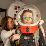
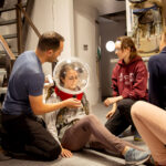
XO Decadi organized and held a training session for emergency procedures in the field, based on the past two days’ EVA experiences and her personal experiences on AMIDEE-18 and with the European Space Agency’s Ariane projects, with the purpose to expose what kind of hazards may happen on the field and how to detect and make decisions on the most appropriate “way for action”. Then we practiced how to remove the helmet/ backpack in different degraded situations as quick as possible.
Addition of Safety Check to Pre-EVA checklist to ensure crewmembers have acclimation with their gear to carry out the emergency contingency procedures we trained on today.
We agreed to plan out EVAs earlier in the day so that the entire crew can be involved.
Destination: Due Southeast of Hab, past MDRS sign.
Coordinates (use UTM WGS 84): 518400 E, 4250600 N
Participants: Julien Villa-Massone (EVA Leader), Kris Davidson (Crew Journalist), Audrey Derobertmasure (HSO).
Road(s) and routes per MDRS Map: Walk to MDRS sign, then head due Southeast.
Mode of travel: Walking
Crew Photos – May 4th


You must be logged in to post a comment.