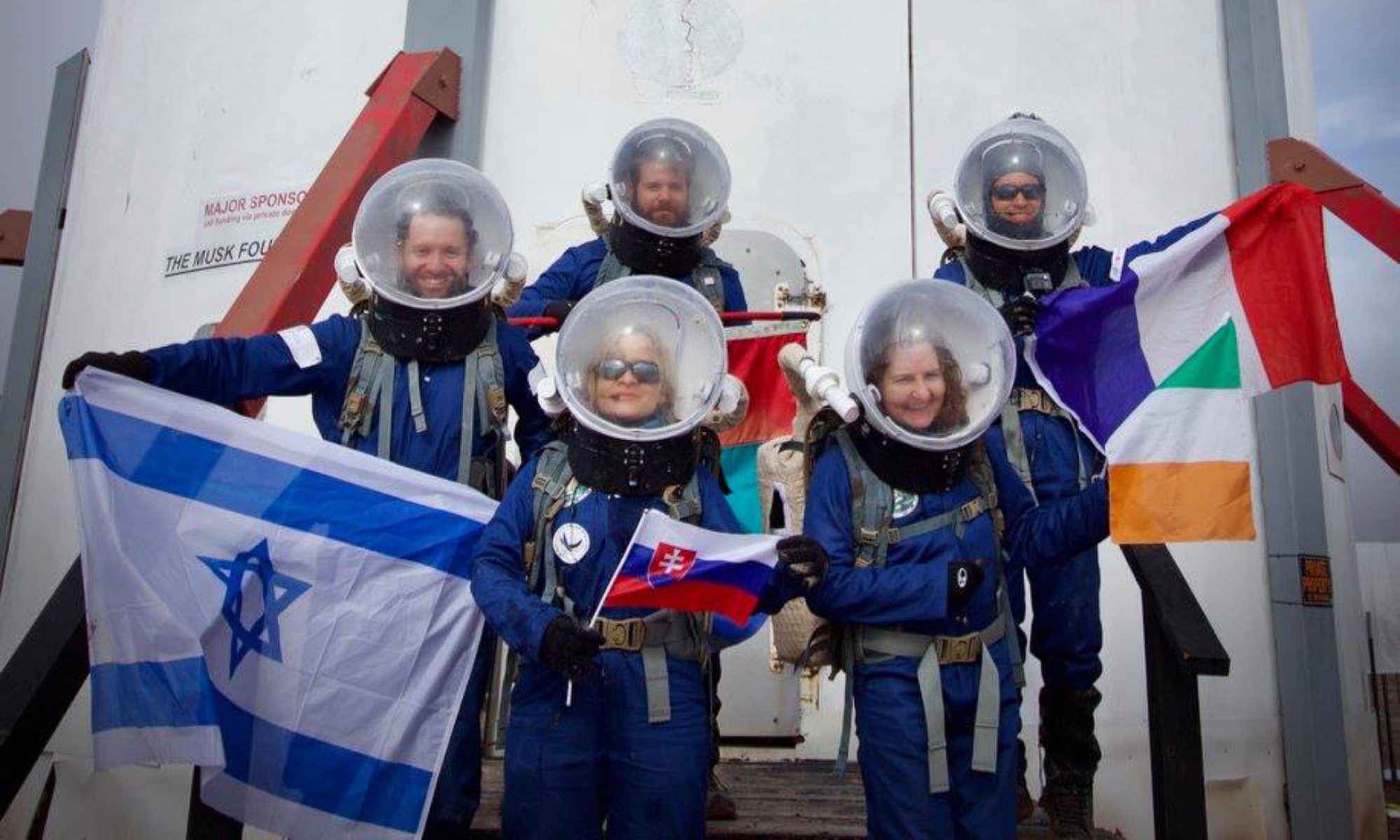

Crew 217 EVA Report
11 Dec 2019

Ann Rockett

EVA Date: Sol 2, 12-11-19

Start time for EVA: 9:00 am

End time for EVA: 12:30 pm

Weather was clear and sunny.

Purpose of EVA:

To investigate the presence of life in water found in potholes study.
Green bands sample collection to bring back to lab for analysis and
identification.

Destination: Lith Canyon

Cow dung road Dino quarry at Lith Canyon traveling by rover and on foot

EVA Participants: Cynthia, Teresa, Kevin, Ann

Narrative:

EVA One (Ann, Cynthia, Kevin, Teresa) journeyed to Lith Canyon. One
of MDRS’s absolute rules is that one stops when the Rovers’ battery
reaches 60%. Do not pass go. Do not collect $200. Do not take the
Rover further afield when the battery reads 60%. About two-thirds
the way to Lith Canyon, Spirit’s battery read 60%. Not to be deterred,
the astronauts continued with their mission, one Rover down. Failure
was not an option.

They successfully collected water samples from three separate
potholes. They also took measured pH and temperature and took
salinity readings They also scaped rock samples from four samples from
the green sediment in the Morrison strata: one from above the green
layer, one from the green layer, one from under the green layer, and
one from a group of crystalline structures in the layer above the
green layer. Finding themselves with over 60 minutes left in their
EVA allotment of time, the group also collected gypsum samples at the
Cow Dung Road/Moon Overlook Road junction.
EVA Report – December 11th
Crew 217 EVA Request 12-11-19

EVA #: 3

Today’s date: Sol 2

Requested EVA Date: Sol 3, 12-12-19

Requested start time for EVA: 10:00 am

Requested end time for EVA:13:00 pm

Weather is clear and sunny supporting the requested EVA.

Purpose of EVA:

To collect ancient invertebrates for presentation to students upon
return to Earth.

Destination:

Walk from Hab up Sagan Street to Hab Ridge (destination)

Coordinates: 518,000, 4251,300 UTM

EVA Participants: Cynthia, Teresa, Kevin, Ann, Jen, Hope
EVA Report – November 25th
 Crew 216 EVA Report 06-Dec-2019
EVA # 16
Author: Whittle
Purpose of EVA: Returning UV samples to Robert's Rock Garden and obtaining film footage in the area west of Zubrin's Head.
start time for EVA: 0830
end time for EVA: 1040
Narrative: Drove to Robert's Rock Garden, returned UV samples to correct locations. Continued to Zubrin's Head. Left vehicles and explored variable terrain to west of Cow Dung Road. Collected lots of footage in circular route over ridges and back along base of wash. Returned to Hab via Cow Dung Road.
Destination: West of Zubrin's Head
Coordinates (use UTM NAD27 CONUS): 12 S 0518501 4248050
EVA Participants: Whittle, Kennedy, Alexandrova
Road(s) and routes per MDRS Map:
1) Drove from Hab to Zubrin's Head (12 S 0519500 4248050) via Cow Dung Road, returning samples at Robert's Rock Garden on route
2) Explored area west of Cow Dung Road on foot, circular route around 12 S 0518501 4248050.
3) Returned to Hab via same route
Mode of travel: Curiosity, Spirit
Crew 216 EVA Report 04Dec2019
[title EVA Report – December 04th]
Crew 216 EVA Report 04-Dec-2019
EVA # 14
Author: Kennedy
Purpose of EVA: To capture film footage in support of Evgenia’s and Ho’s projects.
Start time for EVA: 0830
End time for EVA: 1030
Narrative:Left the Hab on foot with Kennedy, Alexandrova, Levesque, and Ho. We traveled due east towards Phobos peak. In transit we discovered a large dinosaur bone protruding from the side of a cliff. GPS coordinates taken and coordinated with Shannon. We then continued to the southern base of Phobos ridge. Michael stayed at the bottom to run his drone footage. We climbed to the top of the ridge with drone footage and pictures taken from the Hab. We reached the peak around 0945. After returning to the base we returned to the Hab following a more northerly route, passing by several capstone formations “mushrooms” passing in site of the marble ritual, before returning to the Hab at 1030. Both Alexandrova and Ho reported excellent footage being taken for their respective projects.
Destination:Phobos Peak
Coordinates (use UTM NAD27 CONUS): 12 S 0519319E 4250181N
EVA Participants: Alexandrova, Kennedy, Ho, Levesque
Road(s) and routes per MDRS Map:
Road(s) and routes per MDRS Map:
1) Walked to from Hab to base of Phobos Peak
2) Ascended Phobos Peak
2) Returned to Hab from Phobos Peak
Mode of travel: Foot
Vehicles used: None
[end]
Crew 216 EVA Report 04Dec2019
[title EVA Report – December 04th]
Crew 216 EVA Report 04-Dec-2019
EVA # 15
Author: Levesque
Purpose of EVA: To set up a cross-band repeater in the Crew Commander’s vehicle for an attempt to contact the International Space Station via amateur radio.
Start time for EVA: 1230
End time for EVA: 1345
Narrative: Walked to vehicle to set up radio in cross-band mode. Returned to Hab for contact attempt, and then returned to vehicle to shut down radio.
Destination: Crew Commander’s vehicle next to Outpost.
Coordinates (use UTM NAD27 CONUS): 12 S 0518364 4249273.
EVA Participants: Levesque and Lawson
Road(s) and routes per MDRS Map:
1) Walk from Hab to vehicle to set up the repeater
2) Return to Hab for contact attempt with a handheld radio
3) Return to vehicle to shut off repeater and the vehicle
Mode of travel: Foot
[end]
EVA Report – December 3rd
Crew 216 EVA Report 03-Dec-2019
EVA # 13
Author: Whittle
Purpose of EVA: In-situ fluorescent mineral survey. Per agreement with the director, this EVA extended into low light and was therefore partial sim (flight suits only). No photos/videos were taken. Start time for EVA: 1700
End time for EVA: 1820
Narrative: Drove to Robert’s Rock Garden, inspected sites found on EVA 12. Proof of concept completed and a number of samples collected for lab analysis. Returned to Hab via same route.
Destination: Kissing Camel Ridge (Robert’s Rock Garden)
Coordinates (use UTM NAD27 CONUS): 12 S 0518364 4249273.
EVA Participants: Lawson, Whittle, Kennedy
Road(s) and routes per MDRS Map:
1) Drove from Hab to Robert’s Rock Garden via Cow Dung Road
2) Explored Robert’s Rock Garden to mark (GPS) locations for EVA 13 3) Returned to Hab via same route
Mode of travel: Curiosity, Spirit
EVA Report – December 3rd
Crew 216 EVA Report 03-Dec-2019
EVA # 12
Author: Whittle
Purpose of EVA: Reconnaissance for EVA 13 (evening EVA)
Start time for EVA: 0830
End time for EVA: 0915
Narrative: Drove to Robert’s Rock Garden, found 4 sites for evening inspection in vicinity of rovers (<10m from road). All sites marked with GPS and track recorded to annotate map for nighttime navigation. Returned to Hab via same route.
Destination: Kissing Camel Ridge (Robert’s Rock Garden)
Coordinates (use UTM NAD27 CONUS): 12 S 0518364 4249273.
EVA Participants: Lawson, Whittle, Alexandrova
Road(s) and routes per MDRS Map:
1) Drive from Hab to Robert’s Rock Garden via Cow Dung Road
2) Explore Robert’s Rock Garden to mark (GPS) locations for EVA 13 3) Return to Hab via same route
Mode of travel: Curiosity, Spirit
EVA Report #10 – December 2nd
Crew 216 EVA Report 02-Dec-2019
EVA # 10
Author: Whittle
Purpose of EVA: Climb to summit of North Ridge to determine accessible route and identify site for potential repeater site.
Start time: 0830
End time: 1000
Narrative: Crew left Hab on foot. Arrived at North Ridge. Climbed high point on North Ridge at grid 12 S 0518464 4251538. The route taken was via the South West ridge. Time of day was ideal as ground was frozen (and only slightly thawed on decent). Would potentially be hazardous later in the day. Excellent rebroadcast location on top of the ridge. Marked on GPS, along with track of route up (available on request). Fogging was an issue on climb. In visual contact with Hab at all times. Returned to Hab via same route.
Destination: North Ridge
Coordinates (use UTM NAD27 CONUS): 12 S 0518464 4251538.
Participants: Whittle, Kennedy, Levesque
Road(s) and routes per MDRS Map:
1) Walk to North Ridge from Hab
2) Ascend highpoint at 12 S 0518464 4251538 via South West ridge
3) Return to Hab via same route
Mode of travel: Walk
EVA Report – December 2nd
Crew 216 EVA Report 02-Dec-2019
EVA # 11
Author: Kennedy
Purpose of EVA: Gather footage for education (Ho) and documentary (Alexandrova) from dinosaur quarry site.
Start time for EVA: 1330
End time for EVA: 1615
Narrative: Crew left airlock at approx 1335 and left on rovers Spirit and Curiosity, both registering at 100% battery. Road was quite muddy in spots but very manageable. This site is the greatest distance we have yet traveled, as such we minimized excessive accelerations to maximize battery life. We arrived at the parking area for the dinosaur quarry with 62% and 63% battery on our rovers. We examined the site, the quarry has been covered in. Dirt this time of year so nothing to note. We traveled along the ridge to the overlook at 12s 0518250 and 4256590. Michael set up his drone and did aerial photos of the crew. Evgenia used her tripod and took several shots. The canyon had a very distinct shape and rock characteristic that is unique from our other sites. We were quite happy with the outcome of the EVA and feel like we got excellent footage. We returned to our vehicles at 1530 and returned to the airlock in the Hab at 1615.
Coordinates (use UTM NAD27 CONUS): 12 S 0518400 4255800.
EVA Participants: Kennedy, Alexandrova, Ho
Road(s) and routes per MDRS Map:
1) North from Hab to 12 S 0518400 4255800 via Cow Dung Road
2) Explore quarry site and collect footage
3) Return to Hab via same route
Mode of travel: Rover
Vehicles used: Curiosity, Spirit
EVA Report – December 1st
Crew 216 EVA Report 01-DEC-19
EVA # 09
Author: Whittle
Purpose of EVA: EVA footage for Roker film crew filming Crew 216
Start time: 1330
End time: 1515
Narrative: Crew left Hab in Curiosity and Spirit with Justin (Roker crew host) and crew. Arrived at Kissing Camel Ridge. Climbed high point on Kissing Camel Ridge at grid 12 S 0519008 4249540. Collected footage (camera and drone) for the Roker crew. Collected footage with rovers on way back to Hab.
Destination: Kissing Camel Ridge
Coordinates (use UTM NAD27 CONUS): 12 S 0519008 4249540.
Participants: Whittle, Kennedy, Ho, Justin + 5 film crew
Road(s) and routes per MDRS Map:
1) Hab to the point where Kissing Camel Ridge crossed Cow Dung Rd
2) Walked from Cow Dung Rd to the high point at 12 S 0519008 4249540
3) Walked from 12 S 0519008 4249540 back to rovers on Cow Dung Rd
4) Returned to Hab via Cow Dung Rd
Mode of travel: Curiosity, Spirit