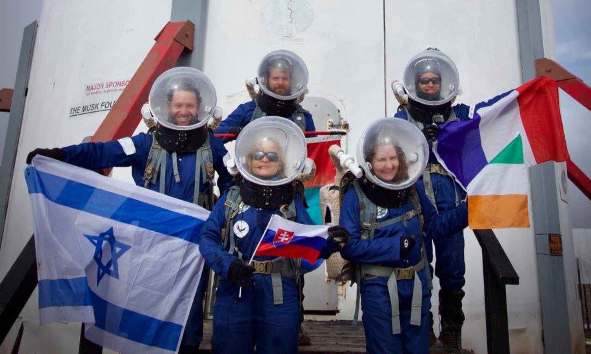

EVA # 5
Author: Tomás Burroni
Purpose of EVA: Collect drone images from el Dorado Canyon to generate the digital elevation model for the second EVA and gather more data for the geolocation project.
Start time: 9:00 am
End time: 11:00 am
Narrative:
We drove from the HAB South through Cow Dung Rd, parking at Zubrin’s head. There, we first took 10 min to do the programmed drone flight to generate the map for the second EVA. We then started walking eastwards into the Canyon and took a soil sample at (519371, 4248609). While inside the Canyon one of the crew members realized that the sound from the suit’s had lowered in intensity. We tried turning it off and on again and they felt that the difference in airflow was lower than expected. This was not noted before as there had been no fog build up in the helmet and the chilly temperature allowed them to stay comfortable even with lower airflow. At that moment we headed straight back to the rovers and the Hab instead of taking the second soil sample as planned. It was not deemed necessary to remove their suit on the way back as the crew member was not suffocating and the helmet was not fogging up.
Destination: Zubrin’s head (vehicle + walking in site)
Coordinates (use UTM WGS 84): 519371 E, 4248609 N
Participants:
· Luis Díaz
· Tomás Burroni
· Andrés D. Reina
Road(s) and routes per MDRS Map: N Cow Dung Rd and Galileo Road.
1. Took East on Entrance Road (Drove)
2. Turned right onto Cow Dung Road (Drove)
3. Walked to the entrance of canyon
4. Walked into the canyon towards the East
5. Returned by the same route.
Mode of travel: Driving on the rovers Opportunity and Curiosity and walking around the canyon, located nearby.
EVA Report – November 3rd
Crew 285 EVA Report 03-11-2023
EVA # 3
Author: Andrea de la Torre
Purpose of EVA: Continue the mapping of Candor Chasma with the drone and make a 2D path to follow with the QFIELD app.
Start time: 9:00 am
End time: 11:45 am
Narrative:
Our mission was focused on capturing GPS coordinates throughout the journey to create a digital route that our colleagues can follow with a mobile app, leveraging the fact that one of our EVA team members was already familiar with the location. Additionally, we deployed an automated drone flight over the Candor Chasma canyon to generate an orthomosaic, a 3D model, and a DMS chart for analyzing the final exploration area for the next EVA team. Furthermore, we collected a soil sample to further our construction material project, using a different type of soil than in previous EVAs.
Destination: Candor Chasma
Coordinates (use UTM WGS 84): (520500,4251000)
Participants:
· David Mateus
· Luis Diaz
· Andrea De La Torre
Road(s) and routes per MDRS Map: N Cow Dung Rd and Galileo Road.
Mode of travel: driving from the HAB north through Cow Dung Rd, turning into Galileo Road. We parked 300 meters before Compass Rock because the SOC of Perseverance was at 65% and we walked to the entrance of the canyon of Candor Chasma.
EVA Report – October 31st
EVA # 1
Author: Luis Diaz
Purpose of EVA: Collecting Martian regolith samples, suiting up with the use of spacesuits, and drone flight.
Start time: 11:05
End time: 12:15
Narrative:
We headed to Marble Ritual to take soil samples and sent the drone to conduct exploration shots in the Candor Chasma area; however, we experienced a slight delay of 2 minutes as we deviated a few meters off the path, quickly returning to the right route.
Once at the scheduled destination point, Andrés began collecting 3.3 kg of Martian regolith while Luis and Marina deployed the drone to execute automatic photo capture tasks for the subsequent generation of a 3D model and contour lines. These will enable us to identify future exploration zones.
Destination:
Coordinates (use UTM WGS 84): 518606,4251022
Participants:
– Luis Diaz
– Marina Buqueras
– Andrés Reina
Road(s) and routes per MDRS Map: N Cow Dung Rd to Marble Ritual zone.
Mode of travel: We use the Curiosity and Spirit rovers.
EVA Report – October 25th
Crew 284 EVA Report 25-10-2023
EVA # 3
Author: Jen Carver-Hunter
Purpose of EVA: Geologic sample collection
Start time: 10:00
End time: 12:00
Narrative: Emily, Deb, and Darin drove to 1101 (the road to Barrainca Butte), where they stopped to collect specimens from the wash on the west side of Cow Dung Rd. After collecting specimens, they returned to the rovers and drove north on Cow Dung Road to the southwest side of Kissing Camels Ridge. There, they collected additional rock specimens along the wash on the west side of Cow Dung Rd before returning to the rovers and continuing on back to the Hab.
Destination: Road to Barranca Butte and Southwest Kissing Camel Ridge
Coordinates (use UTM WGS 84): 519700, 4247300 and 518200, 4249300
Participants: Emily Apgar, Deb DeBerard, Darin Orton
Road(s) and routes per MDRS Map: Crew took rovers from the Hab, turned south on Cow Dung Road, and continued to Route 1101 (the road to Barrainca Butte). They did collect specimens on foot in the wash near the road. From there, they returned North on Cow Dung Rd, stopping at Kissing Camels Ridge before continuing back to the Hab on Cow Dung Rd.
Mode of travel: Crew drove rovers to the collection sites and walked a small area on foot to collect specimens.
EVA Report – October 24th
Crew 284 EVA Report 24-10-2023
EVA # 1
Author: Jen Carver-Hunter
Purpose of EVA: Geologic sample collection
Start time: 11:30
End time: 12:15
Narrative: Loren, Enrique, and Jason were prepped and ready for the EVA on time. Perseverance dropped battery to 75% before the EVA team left the Hab, so they switched out Perseverance for another rover. Before the EVA team reached the halfway point to the first EVA destination, Curiosity had dropped to 60% battery. Crew was instructed to return to the Hab per protocols. EVA Team returned to the Hab with no other issues.
Destination: Intended destination: Intersection with Brahe Hwy followed by mounds near the balancing rock south of dry creek wash. Actual turn around point was near Galileo Rd.
Coordinates (use UTM WGS 84): (Intended coordinates: 518000, 4254750 and 518000, 4254000) Actual turn around point: 519000, 4252000
Participants: Loren Scott, Enrique Arce-Larreta, Jason Trump
Road(s) and routes per MDRS Map: Crew took rovers from the Hab to Cow Dung Rd, turned north onto Cow Dung Rd, and followed that what became their turn around point just south of Galileo Rd.
Mode of travel: Crew drove rovers to the turnaround point.
EVA Report – October 23rd
Crew 284 EVA Report 24-10-2023
EVA # 1
Author: Jen Carver-Hunter
Purpose of EVA: Geologic sample collection
Start time: 11:30
End time: 12:15
Narrative: Loren, Enrique, and Jason were prepped and ready for the EVA on time. Perseverance dropped battery to 75% before the EVA team left the Hab, so they switched out Perseverance for another rover. Before the EVA team reached the halfway point to the first EVA destination, Curiosity had dropped to 60% battery. Crew was instructed to return to the Hab per protocols. EVA Team returned to the Hab with no other issues.
Destination: Intended destination: Intersection with Brahe Hwy followed by mounds near the balancing rock south of dry creek wash. Actual turn around point was near Galileo Rd.
Coordinates (use UTM WGS 84): (Intended coordinates: 518000, 4254750 and 518000, 4254000) Actual turn around point: 519000, 4252000
Participants: Loren Scott, Enrique Arce-Larreta, Jason Trump
Road(s) and routes per MDRS Map: Crew took rovers from the Hab to Cow Dung Rd, turned north onto Cow Dung Rd, and followed that what became their turn around point just south of Galileo Rd.
Mode of travel: Crew drove rovers to the turnaround point.
EVA Report – May 26t
Crew 281 EVA Report 26-05-2023
EVA # 13
Authors: Ritupriya Patil (Executive Officer, EVA Lead), Ana Pires (Crew Scientist)
Purpose of EVA:
Drone flight to record and do aerial imagery for new exploration areas
Acquire vertical images and videos for previously done geotechnical survey of Marble Ritual (Not completed)
Start time: 0738 hrs
End time: 1123 hrs
Narrative:
Today was the longest EVA a crew of two. At 0738 hrs the crew left the airlock for rover checks, then continued to set up for a drone payload test. The objective was to deliver a lightweight medical kit to a simulated injured astronaut, this was to establish a proof of concept for flying drone in an emergency scenario in extreme climate (essentially a high desert); and MDRS was the perfect place. 9 tests were performed, 3 out of those were with zero payload to set up a baseline for the experiment. Ana (Crew Scientist) enacted as the injured analogue astronaut, KC (Crew Engineer) was the HabCom and recorded the flight data; Ritu (XO, EVA Lead) was the drone pilot and experimental flight test lead. There were 2 payloads 25 g and 40 g that were retrieved by Ana, stationed 60 m away from the pilot during the 6 tests. The crew was successful in procuring the payload and flying the drone back safely with the harness intact. Special care was taken, and wind checks were performed prior to each flight. Post flight battery usage after each flight varied based on the combination of the payload weight and winds (between 3-5 knots). On an average the battery usage was from 8% – 15% on the payload flights (higher usage for heavier payload).
The data from this experiment will be used in calculating and scaling the analysis for a bigger drone system that would be capable of carrying heavier load and be flight capable in high winds, and lower air density. This analysis will further feed into design concepts to aid to drone (or a similar system) delivery on Mars.
Next stop for the crew was Marble Ritual, to acquire vertical images and videos for previously done geotechnical survey at the site. Some great shots of the MDRS campus tucked in the red “Martian” terrain were captured from Marble Ritual.
Final objective for today’s EVA was to explore the Special Region. The crew drove north on Cow Dung Road passing the now known landmarks of Pooh’s Corner, Galileo Road, Cowboy Corner, intersection to Brahe Hwy 1572, and then left on Gateway to Lith to reach the destination, formerly known as Burpee Quarry. The crew witnessed sediment depositions from a large river that must have run through the quarry area and created a bend. Ritu got aerial imagery of the location and Ana collected 7 rock samples (226g) and soil samples (299g). The crew accomplished all the EVA goals and with a bittersweet emotion drove back to the hab after their final EVA for the mission. It was an honour to be able to participate in exploration of this “Martian” landscape. It was a humbling experience and the crew would do it again in a heartbeat!
Overview of EVA
Drone payload test to simulate medical emergency delivery
Drive on Cow Dung Road to the North, until Marble Ritual, park and walk right hand side to Marble Ritual scanline boulders
Drive on Cow Dung road further North, take left on Gateway to Lith. Drive 200 m, park on the side of the road and walk no more than 500 m radius
Issues Experienced During EVA
Intermittent comms issues.
Outcomes
Crew completed Rover checks
Acquired vertical images and videos for previously done geotechnical survey of Marble Ritual
Explored Special region, collected rock and soil samples and drone footage
Collected 7 rocks, (226g) and soil samples (299g)
Destination:
MDRS Hab and surrounding 500 m radius
Marble Ritual, walking no more than a radius of 500m;
Special Region
Coordinates :
(use UTM WSG 84): 518100 E, 4250900 N
(use UTM WSG 84): 518687 E, 4250789 N
(use UTM WSG 84): 518424E, 4256117N
EVA Participants 2: Ritupriya Patil (XO, EVA Lead), Ana Pires (Crew Scientist)
Road(s) and routes per MDRS Map:
Walk around the Hab
Drive on Cow Dung Road to the North, until Marble Ritual, park and walk right hand side to Marble Ritual scanline boulders
Drive on Cow Dung road further North, take left on Gateway to Lith. Drive 200 m, park on the side of the road and walk no more than 500 m radius
Mode of travel: Rover
EVA Report – May 25th
Crew 281 EVA Report 25-05-2023
EVA # 12
Authors: Ritupriya Patil (Executive Officer), Ana Pires (Crew Scientist)
Purpose of EVA:
Drone flight to record and do aerial imagery for new exploration areas
Acquire vertical images and videos for previously done geotechnical survey of Marble Ritual (Not completed)
Start time: 0753 hrs
End time: 1112 hrs
Narrative:
This was another long EVA with a crew of three. At 0748 hrs the crew entered the airlock exiting at 0753 hrs. They first checked all the rovers and collected the hours and SoC information, and it was verified that all were securely plugged in. They then unplugged Opportunity and Curiosity and headed out for the first destination at 0758 for the intersection of Cow Dung and Watney Road. The area seemed like a former riverbed; the crew saw lots of sedimentary rocks possibly washed by the flowing water in the past. They also witnessed calcite compressions on the sides of the pathway. The crew walked no more than 600 m and explored. Ana (Crew Scientist) collected 7 rocks (1167 g) and 1 Tube pf soil (72 g). Ritu (XO, EVA Lead) deployed the drone to capture aerial.
For the next stop, the crew wrapped up and drove on Cow Dung Road until they arrived at 1101 Road intersection. From there, they went on foot for about 1 Km and reached Barrainca’s Butte. On the way, they saw Hematite and Ana collected 6 rock samples (789 g) and 1 tube of soil (60g). Ritu was ready for the drone flight and got some great shots of the crew against Barrainca’s Butte with the drone along with other footage of the area.
The crew then left for MDRS and dropped Marble Ritual due to overheating. Today’s EVA was a great reminder of how space and extreme environments can be challenging. A total of almost 2 Km hiking with the suit and backpacks as life-support system was not an easy task in the high sun. Combined with driving the rover without a support for the backpacks to rest on gave the crew some muscle aches. Which is why ergonomics in spacesuit design proves to be an essential aspect of space exploration. Comfortable spacesuits will aid in longer exploration times and achieving research goals.
Also, to add to the challenges of hiking, XO’s waist buckle kept popping open and the backpack would slide down, pulling the weight of the life support system and the helmet on the shoulders. Rest of EVA crew tried to change length of the belt and resetting it but seemed like the buckle has seen some wear and tear over past missions and that wasn’t a permanent fix.
Despite all the pain and exhaustion the expedition was fruitful and left the crew with happiness for exploring one more geological miracle!
Overview of EVA
Drove to the intersection of Cow Dung and Watney Road and then walk no more than a radius of 1 Km to explore the area
Drove further on Cow Dung and 1101 Road intersection and walked 1 Km to north explore Barrainca’s Butte
Issues Experienced During EVA
Intermittent comms issues.
XO, backpack buckle came undone a couple of times while hiking back from Barrainca’s Butte. It could have been due to inadvertent pressure on the belt buckle, and it popped open. Also seems like the buckle has seen a bit of wear and tear.
Outcomes
Crew completed Rover checks
Explored intersection of Cow Dung and Watney Road area, collected soil and rock samples, and drone footage
Explored Barrainca’s Butte region, rock and soil samples and drone footage
Collected 18 rocks, 1.956 Kg; 2 tubes of soil, 132 g
Destination:
Intersection of Cow Dung (Zubrin’s Head) and Watney Road. Then walk 1 Km North East
Intersection of Cow Dung and 1101. Explore Barrainca’s Butte region, and then walk 1 Km to North/ North West
Marble Ritual, walking no more than a radius of 500m; (Depending on Wind conditions)
Coordinates :
(use UTM WSG 84): 519833E, 4248257N
(use UTM WSG 84): 519984E, 4247645N
(use UTM WSG 84): 518687 E, 4250789 N
EVA Participants 3: Ritupriya Patil (XO, EVA Lead), Ana Pires (Crew Scientist), KC Shasteen (Crew Engineer)
Road(s) and routes per MDRS Map:
Drive on Cow Dung Road to the South until the Watney road intersection, park on the side park on the side of intersection
Drive on Cow Dung road further south the intersection of 1101, park on the side of intersection
Mode of travel: Rover
EVA Report – May 24th
Crew 281 EVA Report 24-05-2023
EVA # 11
Authors: Megan Kane (Commander), Ritupriya Patil (Executive Officer), Ana Pires (Crew Scientist)
Purpose of EVA:
Drone payload test and drill
Test attaching a payload harness to the drone
Fly with payload to 100 m (short distance test)
Collect footage
Antenna check to the Northwest of the hab’s rear airlock for Ham Radio set up
Start time: 0905 hrs
End time: 0948 hrs
Narrative:
The EVA crew went out and checked the Rovers before heading to the radio antenna. After assessing the antenna and making sure it was working properly the crew moved on to near the science dome. From within the observatory Ritu commenced the drone payload tests. Six flights were planned. Only 2 were completed due to the wind conditions and slight damage to the propellers of the drone during landing in the windy conditions.
After the drone tests were completed, the EVA crew did a short external inspection of the hab documenting any visible issues. Once this was completed they reentered the Hab.
Overview of EVA
Inspect Antenna setup
Conduct drone tests
Visual inspection of Hab
Issues Experienced During EVA
The winds were too strong to complete the planned drone tests.
Drone was slightly damaged on the return flight. Propellers are slightly dented.
Outcomes
Crew completed Rover check
Crew completed Antenna Inspection
Crew began drone tests, and accomplished one objectives of delivering payload weighing 40 gms
Testing was aborted after the first payload test due to drone damage and winds. We will adjust our procedure to inquire against additional resources for wind conditions. We would recommend installation of wind-sock for continuous wind information.
Crew conducted a visual inspection of the exterior of the Hab
Destination: MDRS Hab and surrounding 500 m radius
Coordinates : Coordinates (use UTM WSG 84): 518100 E, 4250900 N
EVA Participants 2: Rachel Jones (HSO), Ana Pires (Crew Scientist)
Note: Drone pilot, Ritupriya Patil (XO) launched the drone from Musk Observatory and conducted the tests.
Road(s) and routes per MDRS Map: Walk around the Hab
Mode of travel: Walk
EVA Report – May 23rd
Crew 281 EVA Report 23-05-2023
EVA # 10
Authors: Ritupriya Patil (Executive Officer), Ana Pires (Crew Scientist)
Purpose of EVA:
Drone flight to record and do aerial imagery for new exploration areas
Acquire vertical images and videos for previously done geotechnical survey of Pooh’s Corner
Start time: 0750 hrs
End time: 1038 hrs
Narrative:
This was first long EVA with a crew of two. At 0745 hrs the crew entered the airlock exiting at 0750 hrs. They first checked all the rovers and collected the hours and SoC information, and it was verified that all were securely plugged in. They then unplugged Opportunity and headed out for the first destination at 0758 for the intersection of Cow Dung and Hwy 1572. The area was interesting due to the geological features that made a unique mix as if they were partly from moon and mars. The crew witnessed shades and combinations of red and white at various locations around. On arrival to the site, Ana (Crew Scientist) collected 9 rocks (270 g) and soil (55 g). It was drizzling initially but the clouds dispersed by the time the crew arrived and Ritu (XO, EVA Lead) was able to deploy the drone at 0845, capture aerial imagery and videos, and land at 0855 with a 58% battery.
For the next stop, the crew wrapped up and drove on Hwy 1572 until they arrived at the ‘Y’ fork at the Overlook region. Weather was perfect, bright and sunny. Ritu was able to record good footage of the site, with the drone deployed at 0912 and landed at 0924 with 15% battery remaining. Meanwhile, Ana collected 9 rock samples for total of 206 g.
The crew then left for Pooh’s Corner on their way back and acquired vertical and oblique drone images and videos for previously done geotechnical survey for control point 2. This will aid to georeferencing the region under study. The drone batteries were swapped, drone was deployed at 1016 (at 97% battery), the winds had picked up by this time , but the drone was successfully landed at 1025 with 57% battery. The crew left for MDRS right after and arrived at 1037.
During the EVA, the crew observed that Opportunity rover experienced faster drop in the initial 15-20% of battery SoC. By the time they got to the Overlook (almost 7 Km), the charge had dropped to 67%. However, after that the rover’s performance was good and, on the journey back, the SoC was 57%.
Water checks were done approximately every half an hour.
Overview of EVA
Drove to the intersection of Cow Dung and Hwy 1572 and then walk no more than a radius of 100m to explore the area
Drove further on Hwy 1572 to explore the Overlook region, while walking no more than a radius of 500m
On the way back stopped at Pooh’s Corner, walking no more than a radius of 500m;
Issues Experienced During EVA
Comms issues throughout. This was expected per Mission Support’s advice.
Weather was initially an issue with drizzle and winds
XO, suite buckle came undone a couple of times while retrieving the drone from travel packaging. It could have been due to inadvertent pressure on the belt buckle and it popped open.
Outcomes
Crew completed Rover checks
Explored intersection of Cow Dung and Hwy 1572 area, collected soil and rock samples, and drone footage
Explored the Overlook region9 rock samples for total of 206 g and drone footage
Collected drone footage of survey area at Pooh’s Corner collected
Collected 18 rocks, 479 g; 1 tube of soil, 55 g
Destination: MDRS Hab and surrounding 500 m radius
Coordinates :
(use UTM WSG 84): 517533E, 4254823N
(use UTM WSG 84): 516055E, 4254568N
(use UTM WSG 84): 519025 E, 4251183 N
EVA Participants 2: Ritupriya Patil (XO, EVA Lead), Ana Pires (Crew Scientist)
Road(s) and routes per MDRS Map:
Drive on Cow Dung Road take left on Hwy 1572, park on the side of intersection
Drive on Hwy 1572 until the ‘Y’ fork at the Overlook region
Drive on Cow Dung Road and walk left hand side to Pooh’s Corner, scanline boulders
Mode of travel: Rover